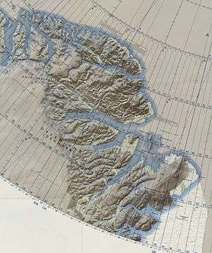
Independence Fjord
| Independence Fjord Independence Sound | |
|---|---|
 Location | |
| Location | Arctic |
| Coordinates | 82°08′N 28°00′W / 82.133°N 28.000°WCoordinates: 82°08′N 28°00′W / 82.133°N 28.000°W |
| Ocean/sea sources | Wandel Sea |
| Basin countries | Greenland |
| Max. length | 130 km |
| Max. width | 16 km |
Independence Fjord or Independence Sound is a large fjord or sound in the eastern part of northern Greenland. It is about 200 km (120 mi) long and up to 30 km (19 mi) wide. Its mouth, opening to Wandel Sea of the Arctic Ocean is located at 82°15′N 21°54′W / 82.250°N 21.900°W. Jørgen Brønlund Fjord is a smaller fjord branching northwest from Independence Fjord.
Geography
This fjord marks the northern boundary of King Frederick VIII Land. The Marie Sophie Glacier and the Academy Glacier have their terminus at the head of the fjord.[1] Princess Thyra Island and Princess Margaret Island are two islands located at the confluence of Denmark Fjord and Independence Fjord.[2]
In the area around the fjord are traces of two paleo-Eskimo cultures known as Independence I culture and Independence II culture after this fjord.
History
The area has been the subject of research since the beginning of the 20th century. The first notable research results about traces of human settlement have been published in 1911 by Christian Bendix Thostrup.[3]
Pre-history
North of the fjord, in southern Peary Land, there are remains of dwellings with elliptical floor plan, built by Early Paleoeskimo Independence I culture. These people used tools made from rocks and bones, and subsisted from hunting wildlife like musk oxen and Arctic hares. Bones of musk oxen hunted down in Peary Land show that the area was inhabited at 2000 BC. The oldest discoveries are dated at 2400 BC. Discoveries of the time starting around 1800 BC until 1300 BC were mostly made south of Independence Fjord. It is unknown whether the Independence I culture vanished or the people moved south.
Discoveries of a later time, about 800 BC to 200 BC, are related to the Independence II culture. Initially, Independence I and Independence II had been regarded as the same culture, but Eigil Knuth found in 1956 that the two were separate cultures, because of different dwelling constructions, and differences in other artefacts. The residential dwellings of Independence II are more complex and larger than the older buildings in this area. Other than their predecessors, the people of Independence II also settled south of Independence Fjord.
In both cases it is unclear whether discoveries in other areas of North Greenland and on Ellesmere Island should be attributed to other cultures.
 Map of Northeastern Greenland. |
 Areas of Independence I and Independence II cultures around Independence Fjord |
.jpg) Navy Cliff in Independence Fjord picture taken during the First Thule Expedition[4] |
See also
References
- ↑ "Catalogue of place names in northern East Greenland" (PDF). Geological Survey of Denmark. Retrieved 21 April 2016.
- ↑ Prinsesse Thyra Ø
- ↑ Christian Bendix Thostrup (1911), Ethnographic Description of the Eskimo Settlements and Stone Remains in North-East Greenland.
- ↑ Independence Fjord, Peary, and the First Thule Expedition
External links
 Media related to Independence Fjord at Wikimedia Commons
- Nationalmuseet: Independence I Culture
- Nationalmuseet: Independence II Culture