Indiana State Road 340
| ||||
|---|---|---|---|---|
 | ||||
| Route information | ||||
| Maintained by INDOT | ||||
| Length: | 5.506 mi[1] (8.861 km) | |||
| Major junctions | ||||
| West end: |
| |||
| East end: |
| |||
| Location | ||||
| Counties: | Clay | |||
| Highway system | ||||
| ||||

State Road 340 in the U.S. state of Indiana is a minor route in Clay County.
Route description
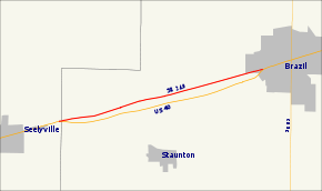
The road begins at U.S. Route 40 in the small town of Cloverland and travels about 5 miles (8.0 km) east to Brazil where it re-joins US 40. It stays within about 1,000 feet (300 m) of US 40 for its entire length.
Major intersections
The entire route is in Clay County.
| Location | mi[1] | km | Destinations | Notes | |
|---|---|---|---|---|---|
| Cloverland | 0.000 | 0.000 | Western terminus of SR 340 | ||
| Brazil | 5.506 | 8.861 | Eastern terminus of SR 340 | ||
| 1.000 mi = 1.609 km; 1.000 km = 0.621 mi | |||||
References
- 1 2 Indiana Department of Transportation (July 2015). Reference Post Book (PDF). Indianapolis: Indiana Department of Transportation. Retrieved October 3, 2016.
External links
This article is issued from Wikipedia - version of the 10/3/2016. The text is available under the Creative Commons Attribution/Share Alike but additional terms may apply for the media files.