Indiana State Road 4
| ||||
|---|---|---|---|---|
 | ||||
| Route information | ||||
| Maintained by INDOT | ||||
| Length: | 38.40 mi[1] (61.80 km) | |||
| Western segment | ||||
| Length: | 25.37 mi[1] (40.83 km) | |||
| West end: |
| |||
| Major junctions: |
| |||
| East end: |
| |||
| Central segment Philip T. Warner Highway | ||||
| Length: | 6.98 mi[1] (11.23 km) | |||
| West end: |
| |||
| East end: |
| |||
| Eastern segment | ||||
| Length: | 6.1 mi[1] (9.7 km) | |||
| West end: |
| |||
| East end: |
| |||
| Location | ||||
| Counties: | Elkhart, DeKalb, Steuben | |||
| Highway system | ||||
| ||||
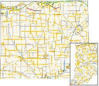
State Road 4 in the U.S. State of Indiana refers to three separate disconnected surface highways in northern Indiana, although local highways that have never been part of the state highway system could in fact connect them.
Route description
Western segment
The western segment is the longest of the three at 25 miles (40 km). This segment begins at LaPorte at State Road 2. It crosses State Road 23 in North Liberty and has a short spur, State Road 104. It ends near Lakeville where it meets U.S. Route 31. SR 4 was extended to the US 31 freeway in conjunction with that facility opening in 2014.[2]
Central segment
The central segment is 7 miles (11 km) long and is the original section, completed in 1926. The western terminus is at State Road 15/U.S. Route 33 in Goshen. The eastern terminus is at State Road 13 in Elkhart County.
Eastern segment
The eastern segment is the shortest of the three at 6 miles (9.7 km). Much of this segment used to be designated as State Road 727 until U.S. Route 27 was re-routed onto the newly completed Interstate 69. The western terminus is at State Road 327 in Helmer, and the eastern terminus is at an interchange with Interstate 69 in Ashley. It runs parallel with an Indiana Northeastern Railroad line, which is just 1,000 feet (300 m) to the north of the highway.
Major intersections
| County | Location | mi[1] | km | Destinations | Notes | ||
|---|---|---|---|---|---|---|---|
| LaPorte | La Porte | 0.00 | 0.00 | Western terminus of SR 4 | |||
| Pleasant Township | 6.53 | 10.51 | Northern terminus of SR 104 | ||||
| St. Joseph | North Liberty | 17.36 | 27.94 | ||||
| Lakeville | 25.37 | 40.83 | Eastern terminus of western segment | ||||
| Gap in route | |||||||
| Elkhart | Goshen | 25.37 | 40.83 | Western terminus of central segment | |||
| Clinton Township | 32.35 | 52.06 | Eastern terminus of central segment | ||||
| Gap in route | |||||||
| DeKalb–Steuben county line | Helmer | 32.35 | 52.06 | Western terminus of eastern segment | |||
| Ashley | 38.40 | 61.80 | Eastern terminus of SR 4; interchange | ||||
| 1.000 mi = 1.609 km; 1.000 km = 0.621 mi | |||||||
References
- 1 2 3 4 5 "INDOT Roadway Referencing System" (PDF). staff.
- ↑ "Pierce Road To Close East of U.S. 31 In Lakeville (press release)". Indiana Department of Transportation. May 11, 2011. Retrieved May 16, 2011.
