Indonesian National Route 9
| ||||
|---|---|---|---|---|
 | ||||
| Route information | ||||
| Length: | 177 km (110 mi) | |||
| Major junctions | ||||
| West end: | Ajibarang | |||
|
Indonesian National Route 6 Indonesian National Route 8 Indonesian National Route 10 Indonesian National Route 14 | ||||
| East end: | Secang | |||
| Highway system | ||||
|
Roads and Highways in Indonesia
| ||||

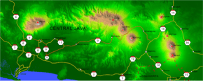
Indonesian National Route 9 connects Ajibarang and Secang.[1][2] The route is located in Central Java.
Route
Ajibarang - Purwokerto - Sokaraja - Kaliori - Banyumas - Klampok - Banjarnegara - Selokromo - Wonosobo - Kretek - Parakan - Bulu - Kedu - Temanggung - Kranggan - Secang
References
- ↑ (Indonesian)http://www.hubdat.web.id/keputusan-dirjen/tahun-2007/561-keputusan-dirjen-no-sk-930aj
- ↑ (Indonesian)Road and Transport map of Java for 2010 Eid Mubarak Going-Home Event by POLRI, Department of Transportation, Department of National Projects, and Jasa Marga

This article is issued from Wikipedia - version of the 12/31/2015. The text is available under the Creative Commons Attribution/Share Alike but additional terms may apply for the media files.