Innværfjorden
| Innværfjorden | |
|---|---|
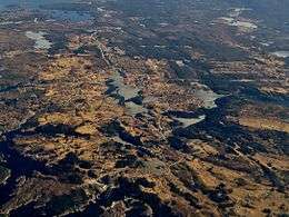 View of the fjord (top, left part of the picture) | |
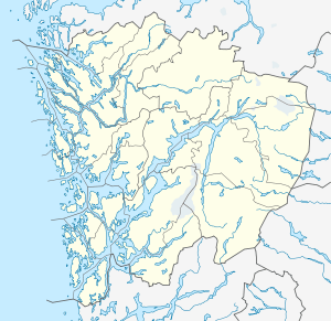 Innværfjorden Location in Hordaland county | |
| Location | Hordaland county, Norway |
| Coordinates | 59°48′09″N 5°15′45″E / 59.8024°N 5.2624°ECoordinates: 59°48′09″N 5°15′45″E / 59.8024°N 5.2624°E |
| Primary outflows | Stokksundet |
| Basin countries | Norway |
| Max. length | 3.5 kilometres (2.2 mi) |
| Settlements | Rubbestadneset |
Innværfjorden is a small fjord in the municipality of Bømlo in Hordaland county, Norway. It lies on the south of the village of Rubbestadneset on the eastern side of the island of Bømlo. The 3.5-kilometre (2.2 mi) long fjord flows to the west from the Stokksundet strait.[1]
The Innværfjorden stretches west from the island of Osparøya between Justenakken and Rubbestadneset and then heads a little southwest. The outermost part of the fjord is about as long as it is wide, and on the south side lies Klenesvågen and Ekornsætre. Along the west side of the fjord lies the small village of Innvær, after which the fjord is named. Between the villages of Innvær and Rubbestadneset, a small, narrow arm of the fjord stretches about 1.5 kilometres (0.93 mi) northwards to Stangarvågen. A 15-metre (49 ft) long bridge that is part of County Road 541 crosses this arm of the fjord on its way to the village of Rubbestadneset.
See also
References
- ↑ "Innværfjorden, Bømlo (Hordaland)" (in Norwegian). yr.no. Retrieved 2015-02-11.