Iowa Highway 23 (1969–1997)
| ||||
|---|---|---|---|---|
 | ||||
| Route information | ||||
| Length: | 14.316 mi[1] (23.039 km) | |||
| Existed: | January 1, 1969 – July 16, 1997 | |||
| Major junctions | ||||
| South end: |
| |||
| North end: |
| |||
| Location | ||||
| Counties: | Wapello | |||
| Highway system | ||||
| ||||

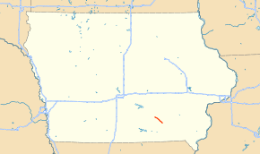
Iowa Highway 23 (Iowa 23) was a 14-mile-long (23 km) state highway in southern Iowa. It ran from U.S. Route 63 (US 63) in Ottumwa to Iowa 137 in Eddyville. It was created in 1969 when it traded route numbers with Iowa 15 in Van Buren County. It was removed from the state highway system in 1997 when US 63 was rerouted between Ottumwa and Oskaloosa.
Route description
Iowa 23 began in downtown Ottumwa underneath a bridge on which US 63 passed overhead. Direct access to US 63 was provided by a ramp which connected to Kitterman Avenue. The first three quarter-miles (1.2 km) of the highway was on a one-way couplet; northbound Iowa 23 followed 2nd Street West, while southbound was on Main Street West. The two directions converged at an intersection with McPherson Street, which is located next to a level crossing of the Dakota, Minnesota and Eastern Railroad.[2] As Iowa 23 left Ottumwa, it traveled northwest on a two-lane highway with narrow shoulders.[3]
Iowa 23 continued to the northwest through rural Wapello County. The entire route paralleled the Des Moines River. Between Ottumwa and Chillicothe, the BNSF Railway runs near the highway and the river. The tracks cross over to the western side of the river halfway between Ottumwa and Chillicothe. An intersection with Chillicothe Road, signed as County Road T67 (CR T67) roughly marked the halfway point of Iowa 23. The second half of the route was more sparsely populated than the first half; corn fields and the occasional country home lined both sides of the highway. Iowa 23 entered Eddyville from the southeast.[4] It ended at a T intersection with Iowa 37. Iowa 23 made up the southern leg while Iowa 137 was the western and northern legs.[5]
History
Iowa 23 was created on January 1, 1969, when the Iowa State Highway Commission renumbered several state highways. Route numbers across the state were changed in order to match up with adjoining highways in neighboring states.[6] In this case, Iowa 23 in Van Buren County was renumbered to Iowa 15 to match Route 15 in Missouri. Similarly, Iowa 15 became Iowa 23 in Wapello County.[7][8] When Iowa 23 was designated in 1969, it had a bituminous surface.[7] It was upgraded to portland cement in 1975.[9]
Iowa 23 ceased to exist on July 16, 1997; it was replaced by a relocated US 63 between Ottumwa and Oskaloosa.[10] A four-lane road connecting Des Moines and Burlington was first proposed in the 1980s. The mayor of Ottumwa supported the option that eventually became US 63, which linked Iowa 23 to US 63 south of the Ottumwa Airport.[11] Box culverts on the section between Ottumwa and Eddyville were built in late 1994 and construction began in earnest in early 1995.[10] When the segment opened, it was the only part of the new Ottumwa-to-Oskaloosa route that was four lanes.[12]
Major intersections
The entire route was in Wapello County.
| Location | mi[1] | km | Destinations | Notes | |
|---|---|---|---|---|---|
| Ottumwa | 0.000 | 0.000 | One-way streets; Iowa 23 began at centerline of US 63 bridge | ||
| 0.037 | 0.060 | Access road to US 63 bridge | |||
| 0.708 | 1.139 | Main Street, McPherson Avenue | End of one-way couplet | ||
| Richland Township | 7.332 | 11.800 | |||
| Eddyville | 14.316 | 23.039 | |||
| 1.000 mi = 1.609 km; 1.000 km = 0.621 mi | |||||
References
- 1 2 "1996 Volume of Traffic on the Primary Road System of Iowa" (PDF). Iowa Department of Transportation. August 1997. Retrieved September 7, 2013.
- ↑ Transportation Map (PDF) (Map). Iowa Department of Transportation. 2013. Retrieved September 7, 2013.
- ↑ Google (September 7, 2013). "Street View – Old Iowa 23 northwest of Ottumwa" (Map). Google Maps. Google. Retrieved September 7, 2013.
- ↑ Iowa Department of Transportation (1997). Iowa State Highway Map (PDF) (Map). Ames: Iowa Department of Transportation. Retrieved September 9, 2013.
- ↑ "Iowa Geographic Map Server". Iowa State University Geographic Information Systems Support & Research Facility. Retrieved September 9, 2013.
- ↑ "New Iowa Map Goes on Sale". Telegraph-Herald. Dubuque, Iowa. January 14, 1969. Retrieved October 10, 2013.
- 1 2 Iowa State Highway Commission (1968). Iowa State Highway Map (PDF) (Map). Ames: Iowa State Highway Commission. Retrieved October 9, 2013.
- ↑ Iowa State Highway Commission (1969). Iowa State Highway Map (PDF) (Map). Ames: Iowa State Highway Commission. Retrieved October 9, 2013.
- ↑ Iowa Department of Transportation (1975). Iowa State Highway Map (PDF) (Map). Ames: Iowa Department of Transportation. Retrieved October 9, 2013.
- 1 2 DeWall, Tricia (July 15, 1997). "New Four-Lane Highway Expected to Open". The Ottumwa Courier. p. 1.
- ↑ Stang, John (August 22, 1989). "Hearing Favors North Route for New Highway 23". The Ottumwa Courier.
- ↑ Iowa Department of Transportation (1998). Iowa State Highway Map (PDF) (Map). Ames: Iowa Department of Transportation. Retrieved January 14, 2014.
External links
- End of Old Iowa 23 Iowa Highway Ends by Jeff Morrison