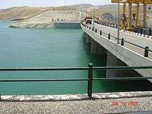
Iran–Turkmenistan Friendship Dam
| Iran–Turkmenistan Friendship Dam | |
|---|---|
 | |
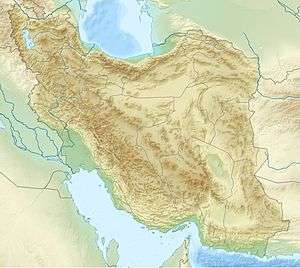 Location of Iran–Turkmenistan Friendship Dam in Iran | |
| Official name | Doosti Reservoir Dam |
| Country | Iran/Turkmenistan |
| Coordinates | 35°56′55″N 61°09′48″E / 35.94861°N 61.16333°ECoordinates: 35°56′55″N 61°09′48″E / 35.94861°N 61.16333°E |
| Status | Operational |
| Opening date | 2005 |
| Owner(s) |
Turkmenistan: Ministry of Water & Land Reclamation Iran: Razavi Khorasan Regional Water Authority |
| Dam and spillways | |
| Type of dam | Embankment, earth-fill |
| Height | 78 m (256 ft) |
| Length | 655 m (2,149 ft) |
| Width (crest) | 15 m (49 ft) |
| Dam volume | 4,500,000 m3 (5,885,778 cu yd)[1] |
| Spillway type | 8 x gated ogee |
| Reservoir | |
| Total capacity | 1,250,000,000 m3 (1,013,391 acre·ft) |
| Active capacity | 735,000,000 m3 (595,874 acre·ft) |
| Inactive capacity | 300,000,000 m3 (243,214 acre·ft) |
| Power station | |
| Turbines | 3 x Francis-type |
| Installed capacity | 16 MW[2] |
The Iran–Turkmenistan Friendship Dam (or Doosti Reservoir Dam) is a dam on the Hariroud River, which forms part of the international boundary between Iran and Turkmenistan. The dam was completed in 2004, and both countries agreed that each would have an equal right to the waters of the river, which amount to 820 million cubic metres.[3] It was officially opened on 12 April 2005.[4] The dam provides drinking water and irrigation for the surrounding areas along with hydroelectric power.[4]
See also
Notes
- ↑ "Doosti Reservoir Dam". ToosAb International Consulting Engineers. Retrieved 30 April 2012.
- ↑ "Doosti reservoir dam". Toosab Consulting. Retrieved 30 April 2012.
- ↑ "Iran–Turkmenistan Friendship Dam to be operational", payvand.com, 2004-11-04.
- 1 2 Food and Agriculture Organization of the United Nations, Regional Office for the Near East, "Iran–Turkmenistan friendship dam to open", 2005-04-09.
This article is issued from Wikipedia - version of the 9/16/2015. The text is available under the Creative Commons Attribution/Share Alike but additional terms may apply for the media files.