Iru Willk'i
| Iru Willk'i | |
|---|---|
 Iru Willk'i Location within Bolivia | |
| Highest point | |
| Elevation | 4,063 m (13,330 ft) [1] |
| Coordinates | 17°57′20″S 68°12′11″W / 17.95556°S 68.20306°WCoordinates: 17°57′20″S 68°12′11″W / 17.95556°S 68.20306°W |
| Geography | |
| Location | Bolivia, Oruro Department |
| Parent range | Andes |
Iru Willk'i (Aymara iru spiny Peruvian feather grass, willk'i gap,[2] "Peruvian feather grass gap", also spelled Iru Willkhi) is a 4,063-metre-high (13,330 ft) mountain in the Andes of Bolivia. It is located in the Oruro Department, San Pedro de Totora Province. It lies at the Q'ara Quta River.[1][3]
References
- 1 2 Bolivian IGM map 1:50,000 Huacanapi 5940-II
- ↑ Radio San Gabriel, "Instituto Radiofonico de Promoción Aymara" (IRPA) 1993, Republicado por Instituto de las Lenguas y Literaturas Andinas-Amazónicas (ILLLA-A) 2011, Transcripción del Vocabulario de la Lengua Aymara, P. Ludovico Bertonio 1612 (Spanish-Aymara-Aymara-Spanish dictionary)
- ↑ "Totora". Retrieved April 12, 2016.
Capital: Oruro | ||
| Provinces | 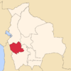 | |
| Municipalities (and seats) |
| |
This article is issued from Wikipedia - version of the 5/2/2016. The text is available under the Creative Commons Attribution/Share Alike but additional terms may apply for the media files.