List of islands of Perth, Western Australia
Perth, Western Australia hosts a variety of unique and biologically diverse habitats found nowhere else on Earth.[1] Many of these habitats include islands. Islands provide habitat and safe refuge for endangered native fauna as they are free of invasive species and the pressures of human development. Coastal islands of this region heavily feature limestone as their base structure, while the inland islands are mainly made of serpentine soil.[2]
Coastal islands
The coastal islands of the Perth Metropolitan Region are:


View of Penguin Island from the Australian mainland.
Rottnest Island satellite islands
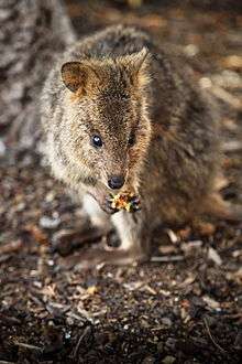
A quokka at Rottnest Island
| Name | Location | Size (m²) | Distance from Rottnest Island (m) | Notes |
|---|---|---|---|---|
| Dyer Island | 32°01′07.8″S 115°33′0.35″E / 32.018833°S 115.5500972°E | 7000 | 730 | Australian sea lions sun themselves on the northern beach.[10] |
| Green Island | 32°01′00.5″S 115°29′57.1″E / 32.016806°S 115.499194°E | 1800 | 60 | Lies within the Kitson Point snorkelling trail.[11] |
| Wallace Island | 32°00′44.6″S 115°33′18.8″E / 32.012389°S 115.555222°E | 1300 | 140 | Known for seabirds resting on the island. |
| Parakeet Island | 31°59′14.9″S 115°30′51.3″E / 31.987472°S 115.514250°E | 800 | 30 | Lies within a popular snorkelling area near Parakeet Bay. |
Inland islands
Inland islands include those located in the Swan River, Canning River, and Beeliar Wetlands.
See also
References
- ↑ "Perth's Banksia Woodlands". Bushlandperth.org.au. Urban Bushland Council WA. Retrieved 11 October 2016.
- ↑ "Online Nursery - Apace WA". Apace.org.au. Apace WA. Retrieved 11 October 2016.
- ↑ "Our History". Rottnest Island. Retrieved 2016-11-26.
- ↑ "Quokka". environment.gov.au. Australian Government. Retrieved 11 October 2016.
- ↑ "Carnac Island | Explore Parks WA | Department of Parks and Wildlife". Parks.dpaw.wa.gov.au. Retrieved 2016-11-26.
- ↑ "Tiger snakes on Carnac Island". members.iinet.net.au. Snakes harmful and harmless. Retrieved 11 October 2016.
- ↑ "Penguin Island Visitor Information". Penguinisland.com.au. Retrieved 2016-11-26.
- ↑ "Management Plan For The" (PDF). Dpaw.wa.gov.au. Retrieved 2016-11-26.
- ↑ "Trigg Island". westernaustralia.com. Tourism Western Australia. Retrieved 13 October 2016.
- ↑ "Dyer Island, Rottnest, Western Australia". Boat Advice. Emma George. Retrieved 18 November 2016.
- ↑ "My Tips for Finding the Best Places for Snorkeling at Rottnest Island". Wild Western Australia. Bonny. Retrieved 18 November 2016.
- ↑ "Belmont Foreshore Precinct Plan" (PDF). Belmont.wa.gov.au. June 2014. Retrieved 2016-11-26.
- ↑ "MANAGE~1.DOC" (PDF). Joondalup.wa.gov.au. Retrieved 2016-11-26.
- ↑ "Ron Courtney Island (island)". Au.geoview.info. Retrieved 2016-11-26.
- ↑ "Fishing Report 11-01-2014 Whew ! It... - Perth & WA Fishing Reports". Facebook. 2014-01-10. Retrieved 2016-11-26.
- ↑ "Lake Monger – An Introduction to the Ecology". MiWER.org. 2014-10-24. Retrieved 2016-11-26.
- ↑ "Lake Jualbup Aquatic Fauna Surveys" (PDF). subiaco.gov.au. City of Subiaco. Retrieved 17 November 2016.
This article is issued from Wikipedia - version of the 12/2/2016. The text is available under the Creative Commons Attribution/Share Alike but additional terms may apply for the media files.