Jálama
| Jálama - Xálima - Xálama | |
|---|---|
 Top of the mountain | |
| Highest point | |
| Elevation | 1,487[1] m (4,879 ft) |
| Prominence | 605 m (1,985 ft) [1] |
| Coordinates | 40°14′19″N 06°45′20″W / 40.23861°N 6.75556°WCoordinates: 40°14′19″N 06°45′20″W / 40.23861°N 6.75556°W [1] |
| Geography | |
 Jálama - Xálima - Xálama Spain | |
| Location |
Cáceres (Extremadura) Salamanca (Castile and León) |
| Parent range | Sierra de Gata (Sistema Central) |
| Climbing | |
| Easiest route | hike |
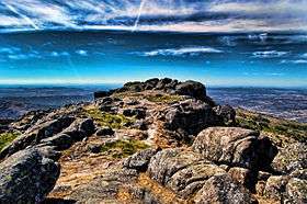
The Jálama is a 1,487-metre (4,879 ft) mountain in western Spain.
Etymology
In the local language of the NE corner of Cáceres province the mountain is known as Xálima.[2] Both names probably come from Paleohispanic languages. The Jálama valley is home to a Galician-like language known as Fala.
Geography
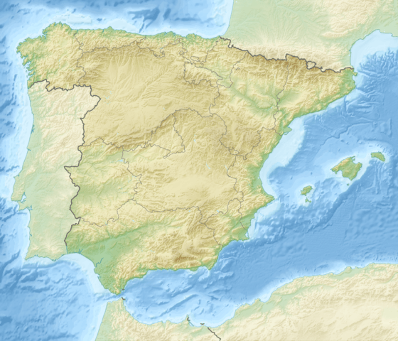
The mountain is located on the border between the provinces of Cáceres (autonomous community of Extremadura) and Salamanca (Castile and León). It's one of the highest peaks of the mountain range called Serra de Xálima. Its summit offers a good view on Salamanca's upland.
Around 3 km NE from the summit, the Arroyo de la Cervigona waters create a 60 m waterfall, the highest in the area.
Access to the summit
The summit can be accessed from Acebo, through the Mirador de La Ventosa (794 m) and the mountain pass of Puerto de Perales.[3]
See also
References
- 1 2 3 "Pico Jálama, Spain". Peakbagger.com. Retrieved September 28, 2015.
- ↑ El mirandés: situación sociolingüística de una lengua minoritaria en la zona fronteriza portugués-española, Academia Llingua Asturiana, 2009; on-line on Google books
- ↑ Vicente Pozas. "Ruta Pico Jálama. Sierra de Gata". andandoextremadura.com. Retrieved September 28, 2015.
External links
- (Spanish) MTB route to Jálama
![]() Media related to Jálama at Wikimedia Commons
Media related to Jálama at Wikimedia Commons