Jardim da Serra
| Jardim da Serra | |
| Civil Parish | |
| Official name: Freguesia de Jardim da Serra | |
| Name origin: Portuguese for mountain garden | |
| Country | |
|---|---|
| Region | |
| Island | Madeira |
| Municipality | Câmara de Lobos |
| Center | Jardim da Serra |
| - elevation | 853 m (2,799 ft) |
| - coordinates | 32°41′32″N 16°59′30″W / 32.69222°N 16.99167°WCoordinates: 32°41′32″N 16°59′30″W / 32.69222°N 16.99167°W |
| Area | 7.36 km2 (3 sq mi) |
| Population | 3,311 (2011) |
| Density | 450/km2 (1,165/sq mi) |
| LAU | Junta Freguesia |
| - location | Rotunda das Cerejeiras, Complexo Civico |
| President Junta | Manuel de Jesus Gonçalves (PPD-PSD) |
| Timezone | WET (UTC0) |
| - summer (DST) | WEST (UTC+1) |
| Postal Zone | 9325-272 |
| Area Code & Prefix | (+351) 291 XXX XXX |
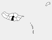 Location of the parish seat of Jardim da Serra in the municipality of Câmara de Lobos, island of Madeira | |
| Wikimedia Commons: Jardim da Serra | |
Jardim da Serra (Portuguese meaning "mountain garden") is a civil parish in the municipality of Câmara de Lobos in the archipelago of Madeira. The population in 2011 was 3,311,[1] in an area of 7.36 km².[2] It is located in the mountains north of the centre of Câmara de Lobos.
References
This article is issued from Wikipedia - version of the 6/24/2014. The text is available under the Creative Commons Attribution/Share Alike but additional terms may apply for the media files.