Jessen (Elster)
| Jessen | ||
|---|---|---|
| ||
 Jessen | ||
Location of Jessen (Elster) within Wittenberg district _in_WB.svg.png) | ||
| Coordinates: 51°47′30″N 12°57′20″E / 51.79167°N 12.95556°ECoordinates: 51°47′30″N 12°57′20″E / 51.79167°N 12.95556°E | ||
| Country | Germany | |
| State | Saxony-Anhalt | |
| District | Wittenberg | |
| Government | ||
| • Mayor | Dietmar Brettschneider (CDU) | |
| Area | ||
| • Total | 351.94 km2 (135.88 sq mi) | |
| Population (2015-12-31)[1] | ||
| • Total | 14,215 | |
| • Density | 40/km2 (100/sq mi) | |
| Time zone | CET/CEST (UTC+1/+2) | |
| Postal codes | 06917, 06918, 06926, 06928 | |
| Dialling codes | 03537, 035387, 035389 | |
| Vehicle registration | WB, GHC, JE | |
| Website | www.jessen.de | |

Jessen is a municipality on the Black Elster river and lies in the eastern part of Saxony-Anhalt in the district of Wittenberg.
Geography
Jessen is an amalgamated municipality, and has the following subdivisions:
|
|
|
History
The first documentary evidence of Jessen's existence dates to 1217. On the night of 20 to 21 September 1729, much of the town was destroyed in a fire. After belonging to Saxony for centuries, Jessen became Prussian in 1816.
In 1945, it became part of the state of Saxony-Anhalt. In 1952, owing to East German administrative reforms, Jessen became a district capital in the Cottbus region (Cottbus is nowadays in Brandenburg). In 1990, Jessen once again became part of the newly-refounded state of Saxony-Anhalt. In 1992 came the amalgamation of the communities of Grabo, Gorsdorf-Hemsendorf, Lindwerder and Großkorga, and in 1993, Schweinitz, Gerbisbach, Klossa, Schöneicho, Steinsdorf and Dixförda. With the district reform in 1994, Jessen became part of Wittenberg district, as well as having a further three communities melded with it, namely Battin, Düßnitz and Kleindröben-Mauken. In 1999 came further amalgamations: Arnsdorf, Leipa and Ruhlsdorf mit Rehain. On 1 March 2004 came a further 12, among them Seyda, Holzdorf and Linda (Elster). Some of these formerly independent communities themselves each consisted of more than one centre, and so Jessen now has a total of 47 Stadtteile (constituent communities).
Economy and infrastructure
Established businesses are mostly small and mid-sized concerns in metalworking, building, dairy processing and drink production. There are also, however, bigger enterprises in agriculture.
Culture and Sightseeing
- Historic marketplace in Jessen
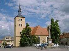
- Parish church of St. Nicolai in Jessen
- Schloss Jessen (stately home), since 1999 town council seat
- Parish church of St. Marien in Schweinitz
- Amtshaus in Schweinitz
- Gorsdorf village church
- Kleindröben village church
- Pretzsch-Mauken reaction ferry
Personalities
- Karl Lamprecht (25 February 1856 – 10 May 1915 in Leipzig), was Professor of History at the University of Leipzig, who is known today mainly for his rôle in the Methodenstreit.
- Herbert Kaiser (16 March 1916 – 5 December 2003) Luftwaffe ace & Knights Cross holder awarded for extreme battlefield bravery. Flew in the first ever jet fighter unit Jagdverband 44
Sundry
The town is Germany's twelfth-largest municipality by land area, and is thereby about 3 km² bigger than Munich.
References
- ↑ "Bevölkerung der Gemeinden – Stand: 31.12.2015" (PDF). Statistisches Landesamt Sachsen-Anhalt (in German).
External links
| Wikimedia Commons has media related to Jessen (Elster). |
Towns and municipalities in the district of Wittenberg | ||
|---|---|---|