Jisr al-Shughur District
| Jisr ash-Shugur District منطقة جسر الشغور | |
|---|---|
| District | |
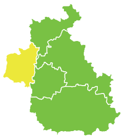 Map of Jisr ash-Shugur District within Idlib Governorate | |
| Coordinates (Jisr ash-Shugur): 35°48′51″N 36°19′12″E / 35.8142°N 36.32°ECoordinates: 35°48′51″N 36°19′12″E / 35.8142°N 36.32°E | |
| Country |
|
| Governorate | Idlib |
| Seat | Jisr ash-Shugur |
| Subdistricts | 4 nawāḥī |
| Area | |
| • Total | 610.89 km2 (235.87 sq mi) |
| Population (2004)[1] | |
| • Total | 150,193 |
| • Density | 250/km2 (640/sq mi) |
| Geocode | SY0704 |
Jisr ash-Shugur District (Arabic: منطقة جسر الشغور, translit. manṭiqat Ǧisr aš-Šuġūr) is a district of the Idlib Governorate in northwestern Syria. Administrative centre is the city of Jisr ash-Shugur. At the 2004 census, the district had a population of 150,193.[1]
Sub-districts
The district of Jisr ash-Shugur is divided into four sub-districts or nawāḥī (population as of 2004[1]):
- Jisr al-Shughur Nahiyah (ناحية جسر الشغور): population 89,028.[2]
- Bidama Nahiyah (ناحية بداما): population 18,501.[3]
- Darkush Nahiyah (ناحية دركوش): population 23,022.[4]
- Al-Janudiyah Nahiyah (ناحية الجانودية): population 19,642.[5]
References
- 1 2 3 "2004 Census Data". UN OCHA. Retrieved 15 October 2015.
- ↑ "Jisr ash-Shugur nahiyah population". Cbssyr.org. Retrieved 2012-06-20.
- ↑ "Bdama nahiyah population". Cbssyr.org. Retrieved 2012-06-20.
- ↑ "Darkoush nahiyah population". Cbssyr.org. Retrieved 2012-06-20.
- ↑ "Janudiyeh nahiyah population". Cbssyr.org. Retrieved 2012-06-20.
External links
 Media related to Jisr ash-Shugur District at Wikimedia Commons
This article is issued from Wikipedia - version of the 5/26/2016. The text is available under the Creative Commons Attribution/Share Alike but additional terms may apply for the media files.