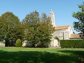
Juillaguet
| Juillaguet | |
|---|---|
 | |
 Juillaguet | |
|
Location within Nouvelle-Aquitaine region  Juillaguet | |
| Coordinates: 45°28′43″N 0°12′49″E / 45.4786°N 0.2136°ECoordinates: 45°28′43″N 0°12′49″E / 45.4786°N 0.2136°E | |
| Country | France |
| Region | Nouvelle-Aquitaine |
| Department | Charente |
| Arrondissement | Angoulême |
| Canton | Villebois-Lavalette |
| Intercommunality | Horte et Lavalette |
| Government | |
| • Mayor (2008–2014) | Jean-Louis Lacourarie |
| Area1 | 7.27 km2 (2.81 sq mi) |
| Population (2008)2 | 133 |
| • Density | 18/km2 (47/sq mi) |
| Time zone | CET (UTC+1) |
| • Summer (DST) | CEST (UTC+2) |
| INSEE/Postal code | 16172 / 16320 |
| Elevation |
103–203 m (338–666 ft) (avg. 166 m or 545 ft) |
|
1 French Land Register data, which excludes lakes, ponds, glaciers > 1 km² (0.386 sq mi or 247 acres) and river estuaries. 2 Population without double counting: residents of multiple communes (e.g., students and military personnel) only counted once. | |
Juillaguet is a former commune in the Charente department in southwestern France. On 1 January 2016, it was merged into the new commune Boisné-la-Tude.[1]
Population
| Historical population | ||
|---|---|---|
| Year | Pop. | ±% |
| 1793 | 230 | — |
| 1800 | 267 | +16.1% |
| 1806 | 283 | +6.0% |
| 1821 | 286 | +1.1% |
| 1831 | 286 | +0.0% |
| 1841 | 288 | +0.7% |
| 1846 | 297 | +3.1% |
| 1851 | 278 | −6.4% |
| 1856 | 255 | −8.3% |
| 1861 | 274 | +7.5% |
| 1866 | 255 | −6.9% |
| 1872 | 241 | −5.5% |
| 1876 | 225 | −6.6% |
| 1881 | 231 | +2.7% |
| 1886 | 222 | −3.9% |
| 1891 | 195 | −12.2% |
| 1896 | 208 | +6.7% |
| 1901 | 204 | −1.9% |
| 1906 | 204 | +0.0% |
| 1911 | 212 | +3.9% |
| 1921 | 206 | −2.8% |
| 1926 | 193 | −6.3% |
| 1931 | 193 | +0.0% |
| 1936 | 177 | −8.3% |
| 1946 | 206 | +16.4% |
| 1954 | 175 | −15.0% |
| 1962 | 147 | −16.0% |
| 1968 | 146 | −0.7% |
| 1975 | 120 | −17.8% |
| 1982 | 118 | −1.7% |
| 1990 | 107 | −9.3% |
| 1999 | 98 | −8.4% |
| 2008 | 133 | +35.7% |
See also
References
- ↑ Arrêté préfectoral 17 November 2015 (French)
| Wikimedia Commons has media related to Juillaguet. |
This article is issued from Wikipedia - version of the 2/12/2016. The text is available under the Creative Commons Attribution/Share Alike but additional terms may apply for the media files.