Kankai Municipality
| Kankai Municipality कन्काई नगरपालिका | |
|---|---|
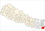
 Kankai Municipality Location of Kankai Municipality in Nepal | |
| Coordinates: 26°38′N 87°59′E / 26.633°N 87.983°ECoordinates: 26°38′N 87°59′E / 26.633°N 87.983°E | |
| Country |
|
| Zone | Mechi Zone |
| District | Jhapa |
| Elevation | 300 m (1,000 ft) |
| Time zone | NST (UTC+05:45) |
| Area code(s) | 023 |
Kankai Municipality is a municipality in Jhapa District of eastern Nepal.
This municipality is formed merging two village development committees i.e. Ghailadubba and Surunga in May 2014.[1][2] This municipality is one of the developed and biggest municipalities in Jhapa.
Trade centers
Tourist Destination
- Kankai Dham (Kotihome)[3]
- Jamunkadhi Simsar
- Domukha
- Dhanuskoti Dham
References
- ↑ 72 new municipalities announced My Republica
- ↑ Govt announces 72 new municipalities The Kathmandu Post
- ↑ "Kankai Dham". Kankai Dham organization.
This article is issued from Wikipedia - version of the 7/28/2016. The text is available under the Creative Commons Attribution/Share Alike but additional terms may apply for the media files.