Karoondi
| Karoondi | |
|---|---|
 | |
| Coordinates: PK 26°53′49″N 68°24′22″E / 26.897°N 68.406°E | |
| Country | Pakistan |
| Province | Sindh |
| District | Khairpur |
| Taluka | Faiz Ganj |
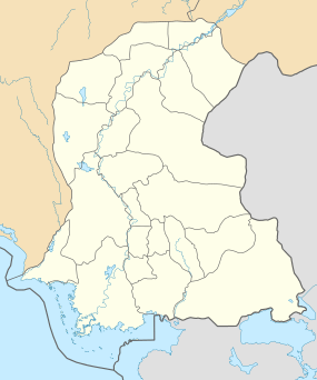
Karoondi (Sindhi:ڪرونڊي) is a small town along Mehran Highway in District Khairpur, Sindh province of Pakistan.[1] It is situated in taluka Faiz Ganj which is one of the eight talukas of the District. The town lies in between two canals: Faiz Ganj canal passes by its western side whereas Veeho canal passes by the eastern. There are fertile farmlands around it and a number of villages in the outskirts. The main town is separated from the bypass bus stop by farm-fields and orchards. The town is relatively a peaceful one as the crime rate is very low and there is harmony among its inhabitants.
Etymology
Oral traditions related by local elders maintain that the town was named after an old woman with a crooked hand who in Sindhi language is called a 'roondee'.
Demographics
The town has a population of about 10,000 people.[2] Islam is the dominant religion but there is a significant number of Hindus belonging to the Scheduled Castes such as Mardecho, Bheel, Ode, etc.They live in ghettoized neighborhoods of the town. Sindhis constitute the majority ethnic group whereas Punjabis have a significant population but have assimilated into the Sindhi culture and are not distinguished.
Among the notable tribes and clans are: Rajper, Mallah, Soomro, Mangi, Kumbher, Iboopota, Khokhar, Rajput, etc. Rajper tribe is the dominant tribe in the area and the town is also under de facto control of Rajper landlords and zemindars who own vast tracts of fertile land around the town and elsewhere.
Sites of Interest
- Shahi Bazaar is the longest shopping street among the towns of the area.
- Phool Baagh is a garden park that was built by late Allahdad Khan Rajper after he was inspired by Shalimar Baagh, Lahore.[3] It is the only park in the area.
- Jamia Masjid Karoondi is a magnificent congregational mosque also built by Allahdad Khan Rajper.
Education
- Govt High School Karoondi is a co-educational school that provides education up to the level of matriculation.
- Govt Degree Science College Karoondi is the only graduation and post-graduation college in taluka Faiz Ganj. It was the result of the efforts by Syed Ali Madad Shah Rashidi, former chief minister Sindh.
- A number of entrepreneurial schools are also offering primary education to the local children in addition to the Govt-run schools.
It must be noted that the land for Govt educational institutions was donated by late Shahnawaz Khan Rajper.
Adjacent Cities and Towns
The nearest city is Nawabshah which is about 80 km to the south and has an airport. Pacca Chang and Akri are the nearest adjacent towns whereas Bhirya road, Thari Mirwah, Padidan, Mehrabpur and Naushahro Feroze are notable towns in the proximity. Bhirya Road Railway Station is the nearest railway station only 13 km away.
Notable People
- Ali Madad Shah - Former Chief Minister (Caretaker) Sindh
- Shaukat Ali Rajper - Renowned Politician
- Akhtar Ali Rajper - Former Nazim (mayor) taluka Faiz Ganj
References
- ↑ "Maps, Weather, and Airports for Karaundi, Pakistan". www.fallingrain.com. Retrieved 2016-07-17.
- ↑ "Karaundi (populated place)". pk.geoview.info. Retrieved 2016-07-08.
- ↑ "Khairpur-Kot Diji". Discover Pakistan. Retrieved 2016-07-11.