Kavresthali, Kathmandu
| Kavresthali काभ्रेस्थली | |
|---|---|
| Village development committee | |
| Nickname(s): Thati | |
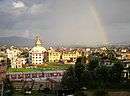
 Kavresthali Location in Nepal | |
| Coordinates: 27°46′N 85°18′E / 27.76°N 85.30°ECoordinates: 27°46′N 85°18′E / 27.76°N 85.30°E | |
| Country |
|
| Zone | Bagmati Zone |
| District | Kathmandu District |
| Population | |
| • Total | 4,774 |
| Time zone | Nepal Time (UTC+5:45) |
Kavresthali is a village in Kathmandu District in the Bagmati Zone of central Nepal. At the time of the 2011 Nepal census it had a population of 4,774 and had 1007 houses in it.[1]
Kavresthali is in the northern side of Kathmandu valley and is 3 km(V.D.C.office located at 5.5 km.)away from ring road. It is popular for its natural beauty as it lies in the lap of Shivapuri National Park.
Kavresthali Village Development Committee Consists of 9 wards. Ward No. 9 mainly consists of Tamang who are believed to migrate from Tibet and it is also called as Devisthan.
list of school
Kavresthali secondary school °Green hills academy °kalidevi secondary school °milan dharmasthali
References
Headquarter: Kathmandu | |||
 |  | ||
This article is issued from Wikipedia - version of the 5/12/2016. The text is available under the Creative Commons Attribution/Share Alike but additional terms may apply for the media files.