Kaweah Gap
| Kaweah Gap | |
|---|---|
 | |
| Elevation | 10,689 ft (3,258 m)[1] |
| Traversed by | High Sierra Trail |
| Location | Tulare County, California, US |
| Range | Great Western Divide, Sierra Nevada |
| Coordinates | 36°33′23″N 118°33′04″W / 36.5563283°N 118.5512053°WCoordinates: 36°33′23″N 118°33′04″W / 36.5563283°N 118.5512053°W [1] |
| Topo map | USGS Triple Divide Peak |
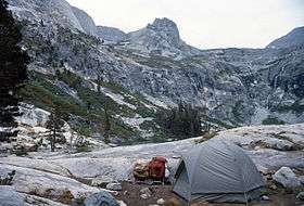
The Kaweah Gap (/kəˈwijə/) is the lowest east-west pass through the Great Western Divide, in Sequoia National Park, California, United States. The High Sierra Trail is routed through this pass.[2]
References
- 1 2 "Kaweah Gap". Geographic Names Information System. United States Geological Survey. Retrieved 2008-11-25.
- ↑ Dilsaver, L.M.; W.C. Tweed (1990). "Selling Sequoia: The Early Park Service Years (1916-1931)". Challenge of the Big Trees. Sequoia National History Association.
This article is issued from Wikipedia - version of the 6/8/2014. The text is available under the Creative Commons Attribution/Share Alike but additional terms may apply for the media files.