Kem (Yenisei)
| Kem (Кемь) | |
| River | |
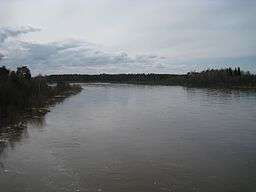 Kem river during the flood season | |
| Country | |
|---|---|
| Region | |
| District | |
| Source | |
| - coordinates | RU 57°06′06″N 92°38′02″E / 57.10167°N 92.63389°E |
| Mouth | Yenisei River |
| - coordinates | RU 58°31′04″N 92°05′44″E / 58.51778°N 92.09556°ECoordinates: RU 58°31′04″N 92°05′44″E / 58.51778°N 92.09556°E |
| Length | 356 km (221 mi) |
| Basin | 8,940 km2 (3,452 sq mi) |
| Discharge | for 141 km from the mouth |
| - average | 12.86 m3/s (454 cu ft/s) |
Kem (Russian: Кемь) is a river in Siberian in Russian Krasnoyarsk Krai.[1] It is a left bank tributary of the Yenisei River.[1] The name of the River Kem comes from the ancient word "kem" or "hem" that has a meaning of "great river".[2] This toponymy is very popular and widespread from Siberia up to the Karelia and Finland.[2] The river flows across the West Siberian Plain through the districts of Bolshemurtinsky, Kazachinsky, Pirovsky, and Yeniseysky District before discharging into the Yenisei River close to the town of Yeniseysk at 2045 kilometers before the mouth.[2] The River Kem is 356 kilometres (221 miles) long.[1] The Kem River basin covers a total area of 8,940 square kilometres (3,452 square miles).[1] The most important tributaries of the River Kem are Tiya (Russian: Тыя) at the 97 kilometer from the mouth and Belaya (Russian: Белая) at the 115 kilometer from the mouth. Both major tributaries are on the left side. Source of the River Kem is located in Bolshemurtinsky District where it originate as a small creek in the East Siberian taiga.[3] Due to the tributary rivers, towards the mouth river reaches 45 meters of width.[3]
River Kem flows mostly through the plain and vegetation grows directly up to the river shores and water.[3] The bottom of the river is covered with a lot of clay and sandy-clay and a river water is generally not clear.[3] The upper reaches of the river flows through the mixed type taiga covered with conifers (larch, fir, spruce, cedar), birch and aspen, as well as through the areas that that are categorized as a standard mixed forest.[3] Due to the tributary rivers, towards the mouth river reaches 45 meters of width.[3] Kem's Biological Reserve is located on the 16 000 hectares of the land that stretched along the banks of the river.[4] In 1963 the project of restoration of population of beavers started here with 20 individuals of this specie being brought in the region.[4]
References
- 1 2 3 4 "Большая Советская Энциклопедия-Кемь (река в Красноярском крае)". Retrieved November 6, 2016.
- 1 2 3 "Научно-популярная энциклопедия «Вода России»: Кемь". Retrieved November 6, 2016.
- 1 2 3 4 5 6 "Русская рыбалка-Река Кемь (Красноярский край)". Retrieved November 6, 2016.
- 1 2 "Борьба за бобра, Наш Красноярский край, Елена ЛАЛЕТИНА". Retrieved November 6, 2016.