Kfar Hananya
| Kfar Hananya כְּפַר חֲנַנְיָה | |
|---|---|
 | |
 Kfar Hananya | |
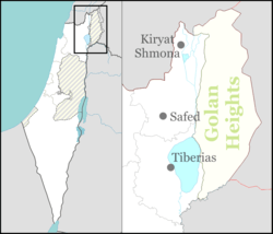
| Coordinates: 32°54′56.52″N 35°25′21.36″E / 32.9157000°N 35.4226000°ECoordinates: 32°54′56.52″N 35°25′21.36″E / 32.9157000°N 35.4226000°E | |
| District | Northern |
| Council | Merom HaGalil |
| Affiliation | Hapoel HaMizrachi |
| Founded | 1977 |
| Founded by | Hapoel HaMizrachi |
| Population (2015)[1] | 669 |
| Name meaning | Hananya village |
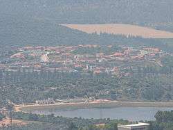
Kfar Hananya (Hebrew: כְּפַר חֲנַנְיָה) is a communal settlement in the Galilee in northern Israel. It belongs to the Merom HaGalil Regional Council. In 2015 it had a population of 669.
The village marks the border between the historic Upper and Lower Galilee regions. Lower Galilee is defined in the Mishnah (Shevi'it 9:2) as the area south of Kfar Hananya where the Sycamore Fig tree grows (Ficus sycomorus).
History
Kfar Hananya was founded in 1977 as a moshav of the movement Hapoel HaMizrachi for members of nearby moshavim, built near the older village which formerly bore the same name, Kafr 'Inan. In 1992 it became a communal settlement. A new neighborhood built in the 2000s is called "Maale Hen" (מעלה חן).
The village is named after the ancient village of the same name, which is mentioned in the mishnah as a community on the border between the Lower Galilee and Upper Galilee. Near the community is a burial place attributed to Rabbi Hananya ben Akashya.
See also
External links
- ↑ "List of localities, in Alphabetical order" (PDF). Israel Central Bureau of Statistics. Retrieved 16 October 2016.