Khorog Airport
| Khorog Airport | |||||||||||
|---|---|---|---|---|---|---|---|---|---|---|---|
| IATA: none – ICAO: UTOD | |||||||||||
| Summary | |||||||||||
| Airport type | Public | ||||||||||
| Operator | Government | ||||||||||
| Serves | Khorog, Tajikistan | ||||||||||
| Elevation AMSL | 6,700 ft / 2,042 m | ||||||||||
| Coordinates | 37°30′08″N 071°30′48″E / 37.50222°N 71.51333°E | ||||||||||
| Map | |||||||||||
 Khorog Location of airport in Tajikistan | |||||||||||
| Runways | |||||||||||
| |||||||||||
Khorog Airport (ICAO: UTOD) is an airport serving Khorugh[1] (also spelled Khorog), a city in the Gorno-Badakhshan Autonomous Province in Tajikistan.
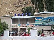
Khorug Airport in 2009
Facilities and aircraft
The airport resides at an elevation of 6,700 feet (2,042 m) above mean sea level. It has one runway designated 16/34 with an asphalt surface measuring 1,840 by 49 metres (6,037 ft × 161 ft).[1] Aga Khan Foundation has plans to build a new runway at the airport.[3]
Airlines and destinations
| Airlines | Destinations |
|---|---|
| Tajik Air | Dushanbe[4] |
References
- 1 2 3 Airport information from DAFIF (effective October 2006)
- ↑ Airport information for UTOD at Great Circle Mapper. Source: DAFIF (effective October 2006).
- ↑ http://dlca.logcluster.org/display/public/DLCA/2.2.5+Tajikistan+Khorog+Airport, 2014
- ↑ http://dlca.logcluster.org/display/public/DLCA/2.2.5+Tajikistan+Khorog+Airport, 2014
External links
This article is issued from Wikipedia - version of the 11/27/2016. The text is available under the Creative Commons Attribution/Share Alike but additional terms may apply for the media files.