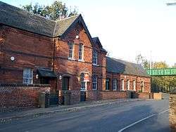
Kimberley East railway station
| Kimberley East | |
|---|---|
|
The station in 2006. | |
| Location | |
| Place | Kimberley |
| Area | Broxtowe |
| Operations | |
| Original company | Great Northern Railway |
| Post-grouping |
London and North Eastern Railway London Midland Region of British Railways |
| Platforms | 2 |
| History | |
| 1 August 1876[1] | Opened as Kimberley |
| 13 June 1955 | Renamed Kimberley East |
| 7 September 1964 | Closed to passengers |
| 2 November 1964[2] | Goods facilities withdrawn |
| Disused railway stations in the United Kingdom | |
|
Closed railway stations in Britain A B C D–F G H–J K–L M–O P–R S T–V W–Z | |
|
| |
Kimberley East Railway Station was a station serving the town of Kimberley in Nottinghamshire, England.
History
It was opened by the Great Northern Railway on its Derbyshire Extension in 1875-6
It was on the second summit on the climb through Watnall Tunnel from Basford and Bulwell of what was a hilly line, crossing as it did, several river valleys.[3] Passenger services finished in 1964 and the line finally closed in 1968.
Following the trackbed of this line takes you to the Bennerley Viaduct. This is a grade II listed structure which is still in place on the Nottinghamshire Derbyshire border.
Kimberley's other station was on a line from the Midland Railway's Erewash Valley Line to Nottingham.[4]
| Preceding station | Disused railways | Following station | ||
|---|---|---|---|---|
| Basford North | London Midland Region of British Railways (Derby) Friargate Line |
Awsworth | ||
Present day
The line is now disused although it can still be traced and is used by walkers and horse riders from Kimberley as far as Hempshill Vale towards Nottingham where its trackbed has been used to accommodate Hempshill Hall Primary School.
The station buildings have been converted to residential accommodation. Part of the site of the station platforms is occupied by a car park and commercial workshop units. The former goods yard was occupied as a timber storage yard for many years but was subsequently redeveloped for housing. The rest of the station site and the trackbed towards Watnall (as far as the Newdigate Street road bridge where the cutting has been filled) has been preserved as a nature reserve.
Further reading
- Henshaw, Alfred (2000). The Great Northern Railway in the East Midlands. RCTS. ISBN 0-901115-88-6.
- Kingscott, Geoffrey (2004). Lost Railways of Nottinghamshire. Countryside Books. ISBN 1-85306-884-5.
- Lee, John.M. (2001). A Brief History of Kimberley (First ed.).
- Lee, John.M. (2002). A Brief History of Watnall (First ed.).
References
- ↑ Butt, R.V.J. (1995). The Directory of Railway Stations, Patrick Stephens Ltd, Sparkford, ISBN 1-85260-508-1, p. 133.
- ↑ Clinker, C.R. (October 1978). Clinker's Register of Closed Passenger Stations and Goods Depots in England, Scotland and Wales 1830-1977. Bristol: Avon-AngliA Publications & Services. p. 70. ISBN 0-905466-19-5.
- ↑ Higginson, M., (1989) The Friargate Line:Derby and the Great Northern Railway, Derby: Golden Pingle Publishing
- ↑ http://www.systemed.plus.com/New_Adlestrop_Railway_Atlas.pdf
See also
Coordinates: 52°59′54″N 1°15′30″W / 52.9984°N 1.2582°W
