Kitami Station (Tokyo)
Kitami Station 喜多見駅 | |
|---|---|
 | |
| Location |
Setagaya, Tokyo Japan |
| Operated by | Odakyu Electric Railway |
| Line(s) | Odakyu Odawara Line |
| History | |
| Opened | 1927 |
Kitami Station (喜多見駅; -eki) is a minor stop on the Odakyu Electric Railway Odawara Line straddling the border between Setagaya Ward and Komae City in Tokyo, Japan. It is the 14th station, about 12.7 km, from Shinjuku Station. It was used by an average of about 32,000 passengers daily in 2005. It is serviced by local service and section semi-express trains; all other trains bypass the station.
Layout
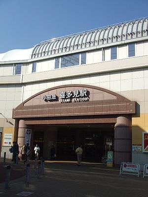
The new station consists of two elevated platforms, with station facilities on the ground floor. There are commercial and food establishments under the train tracks on either side of the concourse.
| 1 | ■ Odakyu Odawara Line | Machida ・ Hon-Atsugi ・ Odawara ・(Hakone-Tozan Railway) Hakone-Yumoto ・(Odakyu Enoshima Line) Fujisawa ・ Katase-Enoshima
(Local) |
| 2 | ■ Odakyu Odawara Line | Shimo-Kitazawa ・ Shinjuku・(Tokyo Metro Chiyoda Line) Ayase ・(Joban Line) Toride
(Local) |
Adjacent stations
| ← | Service | → | ||
|---|---|---|---|---|
| Odakyu Odawara Line | ||||
| Seijōgakuen-Mae | Local | Komae | ||
| Semi-Express: Does not stop at this station | ||||
| Express: Does not stop at this station | ||||
| Tama Express: Does not stop at this station | ||||
| Rapid Express: Does not stop at this station | ||||
| Ltd. Exp. "Romance Car": Does not stop at this station | ||||
History
Kitami Station was opened on April 1, 1927.
Throughout the 1990s it was extensively redeveloped as part of the Odakyu Line's track doubling project. Previous to the redevelopment, the platforms were on ground level and linked by an overhead bridge.
Surroundings
The station lies in a residential area. There is a koban immediately outside the North Exit and a supermarket to the south. A neighbourhood shopping street stretches south. The Odakyu Railway's Kitami train depot lies to the east, alongside the Nogawa river.
There is a Catholic church to the north of the station. It was built in the early 20th Century by Tsurumatsu Toshimitsu, the founder of Odakyu, for his daughter.
The name of the area, Kitami, is thought to originate from an ancient Ainu word meaning "flat, wooded place".
Coordinates: 35°38′12″N 139°35′14″E / 35.6366°N 139.5871°E