Kom–Emine
| Kom–Emine | |
|---|---|
|
Kom–Emine forms the Bulgarian section of the E3 European long distance path | |
| Length | 720 km (447 mi)[1] |
| Location | Balkan Mountains, Bulgaria |
| Elevation | |
| Highest point | Botev Peak, 2,376 m (7,795 ft) |
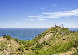
| Lowest point | Cape Emine, 61 m (200 ft) |
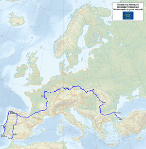
Kom–Emine (Bulgarian: „Ком – Емине“), known during the socialist era as the Friendship Route (Bulgarian: „Маршрут на дружбата“, „Marshrut na druzhbata“), is a high-mountain long-distance trail in Bulgaria. The route follows the main ridge of the Balkan Mountains, which bisect the country and give the Balkan Peninsula its name. Beginning at Kom Peak (2,016 m (6,614 ft)) in the west near the border with Serbia, Kom–Emine continues east for some 600 km (370 mi) until it reaches the Bulgarian Black Sea Coast at Cape Emine.[1][2]
Due to its length and altitude, Kom–Emine counts among Europe's longest uninterrupted high-mountain trails; it is Bulgaria's longest, oldest and most famous hiking trail.[3] Kom–Emine forms part of the wider E3 European long distance path.[1][4]
The trail's average elevation is 735 m (2,411 ft). The middle section, Kom–Emine's highest, coincides with the Central Balkan National Park and regularly rises above 2,000 m (6,600 ft).[2] The highest point of the trail is Botev Peak (2,376 m (7,795 ft)), which is also the highest summit of the Balkan Mountains.[1] In total, around 100 individual peaks are either summited or circumvented.[5]
Typically, the Kom–Emine hike takes 20 to 25 days to complete. The route is marked by white-red-white paint markings and around 30 mountain huts provide accommodation to hikers. Summer is the preferred season to walk Kom–Emine, though the lowest, eastern parts of the trail can get uncomfortably hot.[1]
The trail was first successfully traversed in 1933 by the hiking pioneer Pavel Deliradev, though a route along the entire Balkan Mountains had already been conceived by writer Aleko Konstantinov, who was unable to embark on the hike before his assassination. The first mass through-hike was done in 1953 and the first winter crossing on ski followed in 1961.[5] Bulgarian extreme runner Kiril Nikolov holds the record for the fastest crossing of Kom–Emine. In August 2015, he completed the route in 4 days, 13 hours, 5 minutes and 30 seconds.[4]
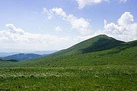
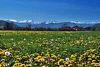
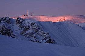
Gallery
|
References
- 1 2 3 4 5 Grancharov, Lyuben (2011). "European Long Distance Walking Paths in Bulgaria". Hiking Guide Bulgaria. Retrieved 15 February 2016.
- 1 2 "International Hiking Trail E3 – Kom – Emine". Central Balkan National Park. Retrieved 15 February 2016.
- ↑ Цветанов, Момчил (2014). Българските планини (in Bulgarian). Домино. p. 293. ISBN 9789546512499.
- 1 2 "Bulgarian Mountain Runner Sets New Record on Completing Kom-Emine Hike". Novinite.com. Retrieved 15 February 2016.
- 1 2 Новаков, Красимир (2008). "От връх Ком до нос Емине (Е-3)" (in Bulgarian). Planinite.info. Retrieved 15 February 2016.