Kuibhir
| Kuibhir Chusku कुइभीर चुस्कु | |
|---|---|
| Village development committee | |
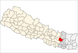
 Kuibhir Chusku Location in Nepal | |
| Coordinates: 27°20′N 86°40′E / 27.33°N 86.66°ECoordinates: 27°20′N 86°40′E / 27.33°N 86.66°E | |
| Country |
|
| Zone | Sagarmatha Zone |
| District | Okhaldhunga District |
| Population (1991) | |
| • Total | 2,121 |
| Time zone | Nepal Time (UTC+5:45) |
Kuibhir Chasku is a village development committee in Okhaldhunga District in the Sagarmatha Zone of mid-eastern Nepal. At the time of the 1991 Nepal census it had a population of 2121 living in 419 individual households.[1]
References
- ↑ "Nepal Census 2001", Nepal's Village Development Committees, Digital Himalaya, retrieved 15 November 2009.
External links
This article is issued from Wikipedia - version of the 1/24/2015. The text is available under the Creative Commons Attribution/Share Alike but additional terms may apply for the media files.