Kukhleh
| Kukhleh כוחלה كحله | |
|---|---|
 Kukhleh | |
| Coordinates: 31°17′13″N 35°02′53″E / 31.287°N 35.048°ECoordinates: 31°17′13″N 35°02′53″E / 31.287°N 35.048°E | |
| District | Southern |
| Council | al-Kasom |
| Population (2015)[1] | 145 |
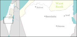
Kukhleh (Arabic: كحله; Hebrew: כוחלה) is a Negev Bedouin village in southern Israel. Located between the Bedouin towns of Hura and Kuseife, it falls under the jurisdiction of al-Kasom Regional Council. In 2015 it had a population of 145.
See also
References
- ↑ "List of localities, in Alphabetical order" (PDF). Israel Central Bureau of Statistics. Retrieved 16 October 2016.
This article is issued from Wikipedia - version of the 9/11/2016. The text is available under the Creative Commons Attribution/Share Alike but additional terms may apply for the media files.