Kunka
| Kunka | |
|---|---|
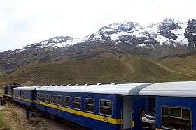
 The train from Lake Titicaca to Cusco near La Raya pass with Kunka in the background | |
| Highest point | |
| Elevation | 5,200 m (17,100 ft) [1] |
| Coordinates | 14°27′40″S 70°59′00″W / 14.46111°S 70.98333°WCoordinates: 14°27′40″S 70°59′00″W / 14.46111°S 70.98333°W |
| Geography | |
 Kunka Peru | |
| Location | Peru, Puno Region |
| Parent range | Andes, La Raya |
Kunka (Aymara and Quechua for throat, gullet, neck, voice,[2][3] hispanicized spelling Cunca) is a mountain in the La Raya mountain range in the Andes of Peru. It is situated at the La Raya Pass and the road and rail which connect Cusco with Lake Titicaca. It is located in the Cusco Region, Canas Province, Layo District, and in the Puno Region, Melgar Province, Santa Rosa District, and about 5,200 metres (17,060 ft) high. Kunka lies southwest of the mountains Yana Khuchilla and Chimpulla. Other neighboring mountains are Huch'uy K'uchu north of it and Hatun Ichhuna Kunka in the south. Between the road and the mountain there is a little lake named Q'umirqucha (Quechua q'umir green, qucha lake,[3] "green lake", Comercocha).
North of Kunka there is a stream called Hatun K'uchu (Quechua for "big corner", hispanicized Atuncucho). It is an affluent of the Willkanuta River which originates near the pass.
Images
-
Train near La Raya station with Kunka (center) in the background
References
- ↑ escale.minedu.gob.pe - UGEL map of the Melgar Province (Puno Region)
- ↑ Radio San Gabriel, "Instituto Radiofonico de Promoción Aymara" (IRPA) 1993, Republicado por Instituto de las Lenguas y Literaturas Andinas-Amazónicas (ILLLA-A) 2011, Transcripción del Vocabulario de la Lengua Aymara, P. Ludovico Bertonio 1612 (Spanish-Aymara-Aymara-Spanish dictionary)
- 1 2 Teofilo Laime Ajacopa, Diccionario Bilingüe Iskay simipi yuyayk'ancha, La Paz, 2007 (Quechua-Spanish dictionary)