Kupang Regency
| Kupang Regency | ||
|---|---|---|
| Regency | ||
| ||
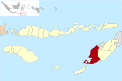 Location of Kupang Regency in East Nusa Tenggara | ||
| Country | Indonesia | |
| Region | Lesser Sunda Islands | |
| Province | East Nusa Tenggara | |
| Capital | Oelamasi | |
| Area | ||
| • Total | 2,277.30 sq mi (5,898.18 km2) | |
| Population (2008) | ||
| • Total | 383,896 | |
| Website | http://www.kab-kupang.go.id/ | |

Kupang Regency is a regency in East Nusa Tenggara province of Indonesia. It occupies the far western end of Timor Island (apart from the area of Kupang city, which is administratively separate), together with the small offshore island of Semau (off the western tip of Timor). Other islands to the southwest and west which were formerly part of Kupang Regency have been separated administratively - the Rote Islands Group in 2002 (to form Rote Ndao Regency), and the Savu Islands in October 2008 (to form Sabu Raijua Regency). The capital of Kupang Regency is at Oelamasi.[1]
Administration
The regency is divided into 24 districts (kecamatan), tabulated below with their 2010 Census population.
| Name | English name | Population Census 2010 |
|---|---|---|
| Semau | Semau Island (North) | 6,688 |
| Semau Selatan | South Semau Island | 4,731 |
| Kupang Barat | West Kupang | 15,417 |
| Kupang Tengah | Central Kupang | 33,805 |
| Kupang Timur | East Kupang | 40,525 |
| Nekamese | 9,010 | |
| Taebenu | 14,594 | |
| Amarasi | 15,279 | |
| Amarasi Barat | West Amarasi | 14,375 |
| Amarasi Selatan | South Amarasi | 10,276 |
| Amarasi Timur | East Amarasi | 7,054 |
| Amabi Oefeto Timur | East Amabi Oefeto | 13,059 |
| Amabi Oefeto | Amabi Oefeto | 7,747 |
| Sulamu | 14,200 | |
| Fatuleu | 23,007 | |
| Fatuleu Tengah | Central Fatuleu | 4,885 |
| Fatuleu Barat | West Fatuleu | 8,399 |
| Takari | 20,262 | |
| Amfoang Selatan | South Amfoang | 8,628 |
| Amfoang Barat Daya | Southwest Amfoang | 4,263 |
| Amfoang Tengah | Central Amfoang | 5,397 |
| Amfoang Utara | North Amfoang | 7,004 |
| Amfoang Barat Laut | Northwest Amfoang | 8,762 |
| Amfoang Timur | East Amfoang | 7,101 |
References
- ↑ Government of Indonesia (9 August 1958), Establishment of the Second-level Administrative Regions under the First-level Administrative Region of Bali, West Nusa Tenggara and East Nusa Tenggara (in Indonesian), Indonesia Ministry of Law and Justice, UU No. 69/1958
External links
Regencies and cities of East Nusa Tenggara | ||
|---|---|---|
Capital: Kupang | ||
| Regencies |  | |
| Cities | ||
Coordinates: 10°18′S 123°43′E / 10.300°S 123.717°E
This article is issued from Wikipedia - version of the 1/8/2015. The text is available under the Creative Commons Attribution/Share Alike but additional terms may apply for the media files.