Kush (mountain)
| Kush | |
|---|---|
| (Persian: کش ) | |
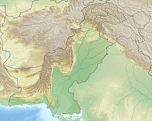 Kush Location in the Hindu Kush | |
| Highest point | |
| Elevation | 2,527 m (8,291 ft) |
| Coordinates | 28°49′1.7″N 66°34′2.7″E / 28.817139°N 66.567417°ECoordinates: 28°49′1.7″N 66°34′2.7″E / 28.817139°N 66.567417°E |
| Geography | |
| Location | Balochistan, Pakistan |
| Parent range | Hindu Kush |
Kush (Persian: کش, Balochi: کش, happy or merry) is a mountain near Kalat, Pakistan Balochistan. The mountain is located below the Durand Line between Afghanistan and India (now Pakistan) in the field of Baloch people. It is located not far from the similarly-named Kushi mountain. The Balochi language is one of the four major Iranian languages (Paschto, Balochi, Kurdi and Persian).
Location
With an elevation of 2,527 metres (8,291 ft), Kush is a mountain near the mountain named Thok in Pakistan. It also known as Kuish. It is in the time zone of Asia/Karachi UTC/GMT+05:00.[1]
Kush, Kash, Kesh, Kosh
The terms such as Kush, Kash, Kosh and Kesh have been used in context with the mountains in the different countries, especially in Iranian plateau (Kurdish regions, Iran, Afghanistan, Pakistan, Tajikistan, Uzbekistan, Turkmenistan), but also even in Ukraine and Poland, especially Kash means in Kurdi (Sorjani), an Iranian language also, mountain ridges and high mountains.[2]
External links
- Kushi, Mountain located near Chota Kapoto which is in Pakistan
- loghatnaameh Dehkhoda
- wiktionary kush Farsi
- Kirkpatrick, William
- Kashi
- Kashgar
- Kashmir
- ḠĀR mountain
See also
Books or dictionaries
- HYDE, Thomas Veterum Persarum et Parthorum et Medorum Religionis Historia], London, MDCC, P.P.. 422
- John Richardson: A Dictionary, Persian, Arabic and English, Vol. 1, ed. Charles Wilkins, London, 1810
- William Kirkpatrick. A vocabulary Persian Arabic and English, containing such words [...], London, 1785
- Hassan Ameed: (first published 1963), Farhang e Farsi e Ameed, Ibn e Sina publications, 1st ed. 1963, 4th ed.1980, Amir Kabir, Tehran
- Hassan Ameed: (first ed. 1963) Farhang e Farsi e Ameed, Ibn e Sina Publications, 4th ed. 1980, Amir Kabir, Tehran
- Hassan Ameed: Farhang e Farsi e Ameed, ed. by Hassan Omid, twelfth edition, 1998, ISBN 964-00-0153-8
- Feryad fazil Omar: Kurdisch-Deutsches Wörterbuch (Kurmancî), Institut für Kurdische Studien e.V., Berlin 1st ed. 1992 ISBN 978-3-932574-06-1
- Feryad fazil Omar: Kurdisch-Deutsches Wörterbuch (Soranî), Institut für Kurdische Studien e.V., Berlin 2005 ISBN 978-3-932574-10-8
- Abdul Rahman Sharafkondi Hazhar: (1st ed. 1990) Farhang Kurdi-Farsi, Tehran, 4th ed. 2005, ISBN 964-435-701-9 and ISBN 964-376-341-2
- Zeeya A. Pashtoon:Pashto-English Dictionary, First Edition, Hyattsville, 2009 ISBN 978-1-931546-70-6
- Akram Malakzay: Großes Wörterbuch Deutsch-Paschto (= Lexicographia Orientali. Band 6). Unter Mitwirkung von David Neil MacKenzie. Buske, Hamburg 2009, ISBN 978-3-87548-516-5.
- Karl Ritter: Die Erdkunde von Asien Vol. 5, Berlin 1837
References
- ↑ "Kush - Mountain Near Thok in Pakistan". Retrieved February 18, 2014.
- ↑ Abdul Rahman Sharafkondi Hazhar (1st ed. 1990) Farhang Kurdi-Farsi, Tehran, 4th ed. 2005, P. 601