Kuusalu Parish
| Kuusalu Parish Kuusalu vald | |||
|---|---|---|---|
| Municipality of Estonia | |||
| |||
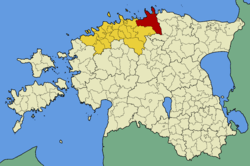 Kuusalu Parish within Harju County. | |||
| Country |
| ||
| County |
| ||
| Administrative centre | Kiiu | ||
| Government | |||
| • Mayor | Urmas Kirtsi | ||
| Area | |||
| • Total | 707.97 km2 (273.35 sq mi) | ||
| Population (01.01.2009) | |||
| • Total | 6,863 | ||
| • Density | 9.7/km2 (25/sq mi) | ||
| Website | www.kuusalu.ee | ||


Kuusalu Parish (Estonian: Kuusalu vald) is a rural municipality in northern Estonia, the largest in Harju County. After joining with the adjacent Loksa Parish in 2005, the municipality has now a population of 6,863 (as of 1 January 2009)[1] and covers an area of 707.97 km².[2] The population density is 9.7 inhabitants per km².
Significant share of the municipality's territory (between 40% and 60%[3]) is covered by protected areas as large parts of the Lahemaa National Park and Põhja-Kõrvemaa Nature Reserve are situated there. Eastern part of the municipality is home to the largest military training area in Estonia, the central training area of Estonian Defence Forces.
Administrative centre of the municipality is Kiiu. There is a total of 3 small boroughs — Kuusalu (1225 inhabitants), Kiiu (893 inhabitants) and Kolga (501 inhabitants) — and 64 villages in Kuusalu Parish: Allika, Andineeme, Aru, Haavakannu, Hara, Hirvli, Ilmastalu, Joaveski, Juminda, Kaberla, Kahala, Kalme, Kasispea, Kemba, Kiiu-Aabla, Kodasoo, Koitjärve, Kolga-Aabla, Kolgaküla, Kolgu, Kõnnu, Kosu, Kotka, Külmaallika, Kupu, Kursi, Kuusalu, Leesi, Liiapeksi, Loksa, Mäepea, Murksi, Mustametsa, Muuksi, Nõmmeveski, Pala, Pärispea, Parksi, Pedaspea, Põhja, Pudisoo, Rehatse, Rummu, Salmistu, Saunja, Sigula, Sõitme, Soorinna, Suru, Suurpea, Tammispea, Tammistu, Tapurla, Tõreska, Tsitre, Turbuneeme, Uuri, Vahastu, Valgejõe, Valkla, Vanaküla, Vihasoo, Viinistu, Virve.
The current mayor (vallavanem) is Urmas Kirtsi.[4]
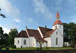 Kuusalu church
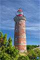 Mohni lighthouse
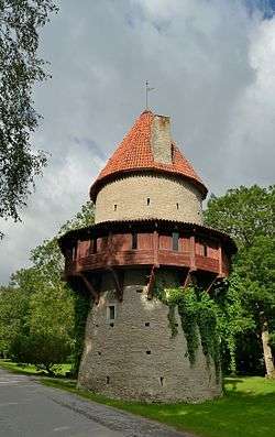 Kiiu tower
 Kolga manor
 Viru bog in winter
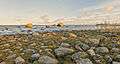 Coast at Pärispea peninsula
 Suru Suursoo in early morning
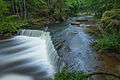 Nõmmeveski waterfall
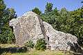 Jaani-Tooma boulder
See also
References
- ↑ "Rahvastik" (in Estonian). Kuusalu vald. Retrieved 13 December 2009.
- ↑ "Kirjeldus" (in Estonian). Kuusalu vald. Retrieved 13 December 2009.
- ↑ Estonian Nature Conservation in 2007 (PDF). Tallinn: Estonian Environment Information Centre. 2008. ISBN 978-9985-881-56-9.
- ↑ "Vallavanem" (in Estonian). Kuusalu vald. Retrieved 13 December 2009.
External links
- Official website (available only in Estonian)
Coordinates: 59°26′38″N 25°26′29″E / 59.44389°N 25.44139°E
| Urban municipalities | ||
|---|---|---|
| Rural municipalities | ||