Kyzyl-Kiya Airport
| Kyzyl-Kiya Airport Кызыл-Кыя аэропорту | |||||||||||
|---|---|---|---|---|---|---|---|---|---|---|---|
| IATA: none (КЫК) – ICAO: UAFS | |||||||||||
| Summary | |||||||||||
| Airport type | Public | ||||||||||
| Operator | Government | ||||||||||
| Serves | Kyzyl-Kiya and Pulgon | ||||||||||
| Location | Kyzyl-Kiya, Kadamjay District | ||||||||||
| Hub for | Kyrgyzstan Air Company | ||||||||||
| Elevation AMSL | 2,928 ft / 892 m | ||||||||||
| Coordinates | 40°16′18″N 072°02′49″E / 40.27167°N 72.04694°ECoordinates: 40°16′18″N 072°02′49″E / 40.27167°N 72.04694°E | ||||||||||
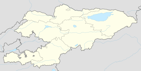
| Map | |||||||||||
 UAFS | |||||||||||
| Runways | |||||||||||
| |||||||||||
The Kyzyl-Kiya Airport (Kyrgyz: Кызыл-Кыя аэропорту, Russian: Кызыл-Кийский аэропорт) (IATA: none (КЫК), ICAO: UAFS) serves Kyzyl-Kiya and Pulgon, towns in Kadamjay District of Batken Province (oblast), Kyrgyzstan. The Russian IATA code for Kyzyl-Kiya Airport is КЫК.[2]
Kyzyl-Kiya Airport started operations in the 1930s as a landing strip near the mining town. The current runway and terminal were built in the 1970s. It is a regional class 3C airport. The runway has a weight limit of 22 tonnes, and has no instrument landing facilities and operates only during daylight hours.
Although Kyzyl-Kiya Airport is near the border with Uzbekistan, it has no customs and border control checks and serves only flights within Kyrgyzstan. Until 2002, Kyzyl-Kiya had year-round links with Bishkek, Osh and Cholpon-Ata.
Airlines and destinations
| Airlines | Destinations |
|---|---|
| Kyrgyzstan Air Company operated by Avia Traffic Company | inspection flights |
References
- ↑ "Kyzyl-Kiya Airport". OurAirports.com. 2012-10-28. Retrieved 2012-10-28.
- ↑ "Коды городов всех стран". G-Avia.ru. 2012-10-28. Retrieved 2012-10-28.
External links
| Wikimedia Commons has media related to Kyzyl-Kiya Airport. |