La Pinareja
| La Pinareja | |
|---|---|
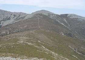 La Pinareja from the Montón de Trigo | |
| Highest point | |
| Elevation | 2,197[1] m (7,208 ft) |
| Prominence | 401 m (1,316 ft) |
| Coordinates | 40°48′32″N 04°05′32″W / 40.80889°N 4.09222°WCoordinates: 40°48′32″N 04°05′32″W / 40.80889°N 4.09222°W |
| Geography | |
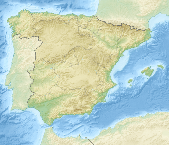 La Pinareja Spain | |
| Location | Segovia Province, Castile and León |
| Parent range | La Mujer Muerta (Sistema Central) |
| Geology | |
| Mountain type | granite[2] |
| Climbing | |
| First ascent | ancestral |
| Easiest route | hike |
La Pinareja is a 2,197-metre-high (7,208 ft) mountain in Spain.
Geography
The mountain is located in El Espinar municipality (Segovia Province), in the south-eastern part of the autonomous community of Castile and León. It's the highest peak of the mountain range called La Mujer Muerta. From its north face a large part of the Segovia's plain can be seen, while its eastern slopes look towards Valsaín and Río Moros valleys.
Access to the summit
The summit can be accessed from Cercedilla through the mountain pass of Puerto de La Fuenfría (1796 m),[3] from Navas de Riofrío (1267 m) or from the village of Revenga (1132 m). During summer these ways can be easily followed, but in winter abundant snow and ice can require crampons and ice axe.
See also
References
- ↑ "La Pinareja ( 2197m )". worldsummits.net (in Spanish). Retrieved July 6, 2015.
- ↑ Time-Out Guide to Madrid. Penguin Group. 1999. Retrieved July 6, 2015.
- ↑ Juan J. "Walk to the Puerto De La Fuenfria". www.vayable.com. Retrieved July 6, 2015.
External links
![]() Media related to La Pinareja at Wikimedia Commons
Media related to La Pinareja at Wikimedia Commons