Lagunitas Creek
| Lagunitas Creek (Tokelalume) | |
| Paper Mill Creek | |
| stream | |
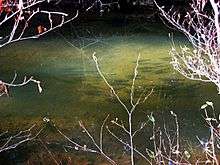
 Pair of endangered coho salmon in Lagunitas Creek. | |
| Name origin: Spanish | |
| Country | United States |
|---|---|
| State | California |
| Region | Marin County |
| Tributaries | |
| - left | Olema Creek |
| - right | Devils Gulch, San Geronimo Creek, Nicasio Creek |
| Source | Mount Tamalpais |
| - coordinates | 37°56′51″N 122°35′50″W / 37.94750°N 122.59722°W [1] |
| Mouth | Tomales Bay |
| - elevation | 0 ft (0 m) |
| - coordinates | 38°4′48″N 122°49′37″W / 38.08000°N 122.82694°WCoordinates: 38°4′48″N 122°49′37″W / 38.08000°N 122.82694°W [1] |
| Length | 20 mi (32 km) |
| Basin | 103 sq mi (267 km2) |
Lagunitas Creek is a 20 miles (32 km)-long northward-flowing stream in Marin County, California. It is critically important to the largest spawning runs of endangered coho salmon (Oncorhynchus kistuch) in the Central California Coast Coho salmon Evolutionary Significant Unit (CCC ESU).[2] The stream's headwaters begin on the northern slopes of Mt. Tamalpais in the Coast Range and terminate in southeast Tomales Bay, 1.5 miles (2.4 km) northwest of Point Reyes Station, California.[3] Lagunitas Creek feeds several reservoirs on Mt. Tamalpais that supply a major portion of the county's drinking water.[4]
History
To the Coast Miwok the stream was known as Tokelalume, then by the Spanish as Arroyo de San Geronimo. Now the "San Geronimo" survives only as the San Geronimo Creek tributary. The modern name, Lagunitas Creek, is derived from the several "lagunitas" (Spanish for "little lakes") which have now been turned into reservoirs by dams in the upper watershed. It was once known as Paper Mill Creek because Samuel P. Taylor built a paper mill on the creek in Taylorville. This mill, the Pioneer Paper Mill, was built in 1856, the first in California.[3][5]
Watershed and Course

Lagunitas Creek's major tributaries include San Geronimo Creek, Devils Gulch, Nicasio Creek, and Olema Creek.[6] The creek's source is the northern slope of Mount Tamalpais, a few miles (~6–8 km) east of Bolinas Lagoon. The creek begins as three forks, the East Fork, Middle Fork and West Fork. After about a mile (1,600 m), they all flow into Lake Lagunitas, which drains into Bon Tempe Lake, which drains into Alpine Lake. Downstream of Alpine Lake, the creek flows roughly northwest until it reaches Kent Lake. Just downstream of Kent Lake, San Geronimo Creek joins the creek. Lagunitas continues northwest through Samuel P. Taylor State Park and is joined by Nicasio Creek, which flows from Nicasio Reservoir, another water storage reservoir. Shortly after this confluence, Lagunitas turns westward and flows through the town of Point Reyes Station. On the west side of the town, the creek is joined by Olema Creek, the largest tributary in the Lagunitas Creek watershed. Olema Creek receives Bear Valley Creek, and mainstem Olema Creek flows for 9 miles (14 km) along the San Andreas Fault Zone, with a catchment area of 14.5 square miles (38 km2).[4] After receiving the waters of Olema Creek, Lagunitas Creek turns northward and then empties into the wetlands at the southeast end of Tomales Bay.
The Lagunitas Creek watershed drains 103 square miles (270 km2).[4] Most of its major tributaries are dammed, including the Kent, Alpine, Bon Tempe, Lagunitas, and Nicasio reservoirs.[6] The San Geronimo Valley is the last un-dammed headwater tributary of Lagunitas Creek. Each of the reservoirs in the watershed has a dam and the biggest problem in the watershed is their blocking of the streams, which prevents fish migration. The dams dewater the streambed, especially as the first winter rains fill the reservoirs instead of flowing downstream. Also, water from the late winter rains are partially lost from streamflows because of evaporation from the reservoir surfaces.
Erosion is also a significant problem in the watershed. Sedimentation from Lagunitas Creek into Tomales Bay resulted from nineteenth century logging and cattle grazing of riparian plants which otherwise slow erosion. However, sediment loads have been decreasing since the mid-twentieth century and the tidal marsh at the mouth of the creek is no longer aggrading likely due to sediment capture in the many upstream reservoirs.[7]
Sir Francis Drake Boulevard follows the course of San Geronimo Creek west and then north along mainstem Lagunitas Creek through Samuel P. Taylor State Park.
Ecology
The Lagunitas Creek Watershed is home to the largest remaining wild run of coho salmon (Oncorhynchus kisutch) in Central California. These coho are part of the "Central California Coast Evolutionarily Significant Unit," or CCC ESU, and are listed as "endangered" at both the state and federal level.[2] Significant efforts to protect and restore these fish have been underway in the Watershed since the 1980s. Fifty-percent of historical salmon habitat is now behind dams. Strong efforts are also being made to protect and restore undammed, headwater reaches of this Watershed in the San Geronimo Valley, where upwards of 40% of the Lagunitas Creek salmon spawn each year and where as much as 1/3 of the juvenile salmon (or fry) spend their entire freshwater lives. Roy's Dam on San Geronimo Creek was built in the 1920s to supply water to a ranch. It was an obstacle for coho salmon and steelhead trout trying access to the habitat upstream of the dam for spawning. It was decided to lower the dam instead of completely removing it because of the large amount of sediment that had accumulated behind the dam. This re-opened critical spawning habitat no longer available on other Lagunitas Creek tributaries. The Salmon Protection and Watershed Network ([1]) leads winter tours for the public to learn about and view these spawning salmon, and also leads year-round opportunities for the public to get involved in stream restoration, monitoring spawning and smolt outmigration, juvenile fish rescue and relocation in the summer, and advocacy and policy development.
Below Kent Lake and the San Geronimo Creek confluence, the mainstem Lagunitas Creek courses through Samuel P. Taylor State Park, which hosts 600 acres of redwoods (Sequoia sempervirens) virgin forest.
In literature
Under the name Paper Mill Creek, Lagunitas Creek is referred to, and crossed several times by car, in the course of Confessions of a Crap Artist, a novel by Philip K. Dick, partly set in Marin County.
See also
References
- 1 2 U.S. Geological Survey Geographic Names Information System: Lagunitas Creek
- 1 2 Peter B. Moyle; Joshua A. Israel; Sabra E. Purdy (2008). Salmon, Steelhead and Trout in California - Status of an Emblematic Fauna (PDF) (Report). Center for Watershed Sciences, University of California, Davis. Retrieved 2014-02-08.
- 1 2 David L. Durham. Durham's Place Names of the San Francisco Bay Area. Clovis, California: Quill Driver Books/Word Dancer Press. p. 87. ISBN 1884995357.
- 1 2 3 The Tomales Bay Watershed Stewardship Plan: A Framework for Action (PDF) (Report). Tomales Bay Watershed Council. July 2003. p. 137. Retrieved 2014-02-02.
- ↑ Erwin Gustav Gudde (1960). California Place Names: The Origin and Etymology of Current Geographical Names. University of California Press. p. C-170. Retrieved 2014-02-02.
- 1 2 "Tomales Bay Watershed". Marin County Department of Public Works. Retrieved 2014-02-02.
- ↑ Tina M. Niemi & N. Timothy Hall (1996). "Historical Changes in the Tidal Marsh of Tomales Bay and Olema Creek, Marin County, California". Journal of Coastal Research. 12 (1): 90–102. Retrieved 2014-02-08.
External links
- SPAWN, Salmon Protection and Watershed Network
- Trout Unlimited California
- Oakland Museum of California
- Klamath Resource Information System
- Video of North American river otter (Lontra canadensis) in Lagunitas Creek watershed