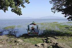
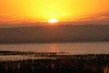
Lake Awasa
| Lake Awasa | |
|---|---|
 | |
 Lake Awasa is the small lake near the bottom of the map, just west of the town of Awasa. | |
| Coordinates | 7°03′N 38°26′E / 7.050°N 38.433°ECoordinates: 7°03′N 38°26′E / 7.050°N 38.433°E |
| Primary outflows | subterranean (?) |
| Basin countries | Ethiopia |
| Max. length | 16 km |
| Max. width | 9 km |
| Surface area | 129 km² |
| Max. depth | 10 m |
| Surface elevation | 1,708 m |
Lake Awasa is an endorheic basin in Ethiopia, located in the Main Ethiopian Rift south of Addis Ababa. According to the Statistical Abstract of Ethiopia for 1967/68, the lake is 16 km long and 9 km wide, with a surface area of 129 square kilometers. It has a maximum depth of 10 meters and is located at an elevation of 1,708 meters.
Because it is relatively accessible to scientists, Lake Awasa is the most studied of the Rift Valley lakes in Ethiopia. According to William Taylor, a member of the African Lakes and Rivers Research Group at the University of Waterloo, Lake Awasa is, despite its lack of an outflow, "essentially a freshwater lake (conductivity is variable, but less than 1,000) indicating that it must have a subterranean outlet."[1]
See also
Notes
- ↑ Lake Awassa, University of Waterloo website (accessed 1 October 2006)
External links
| Wikimedia Commons has media related to Lake Awasa. |
- "Lake Awassa". International Lake Environment Committee Foundation. 1999.