Lake Bumbunga
| Lake Bumbunga | |
|---|---|
|
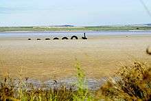
Lake Bumbunga facing east | |
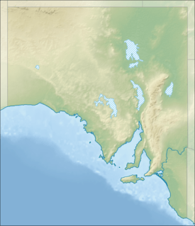 Lake Bumbunga Location in South Australia | |
| Location | Mid North region, South Australia |
| Coordinates | 33°54′S 138°11′E / 33.900°S 138.183°ECoordinates: 33°54′S 138°11′E / 33.900°S 138.183°E |
| Type | Salt lake |
| Basin countries | Australia |
| Surface area | 13.88 km2 (5.36 sq mi)[1] |

Lake Bumbunga is a salt lake located in South Australia's Mid North near the towns of Lochiel and Bumbunga.
Description
According to anthropologist Norman Tindale the name was derives from the Parnpangka (local indigenous) term for 'rain water lake'.[2]
Salt has been mined at the salt extraction works since 1912.[3][4][5]
The lake is fed by surrounding hills including the Hummocks Range.
See also
References
- ↑ WETLAND INVENTORY, NORTHERN AGRICULTURAL DISTRICTS OF SOUTH AUSTRALIA, An assessment of selected inland wetlands of the Northern Agricultural Districts. (page 16)
- ↑ "Place Names of South Australia - B - Bumbunga". Manning Index of South Australian History. State Library of South Australia. Retrieved 15 July 2016. Index compiled based on Manning, Geoffrey H. (2006). Manning's Place Names of South Australia from Aaron Creek to Zion Hill. Modbury, South Australia: Gould Books. ISBN 9780947284602.
- ↑ "Salt production in South Australia - Lochiel]". Primary Industries and Resources South Australia (PIRSA).
- ↑ "Number 1. Early Salt Production in South Australia". Historical Cameos of Early South Australia.
- ↑ Hough, Joanne K (September 2008). "Salt production in South Australia" (PDF). MESA Journal. PIRSA, Government of South Australia. 50: 32. Retrieved 15 July 2016.
External links
This article is issued from Wikipedia - version of the 7/14/2016. The text is available under the Creative Commons Attribution/Share Alike but additional terms may apply for the media files.