Lake Tobesofkee
| Lake Tobesofkee | |
|---|---|
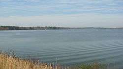 Lake Tobesofkee in the wintertime | |
| Location | Bibb County, Georgia |
| Coordinates | 32°48′56″N 83°47′55″W / 32.81556°N 83.79861°WCoordinates: 32°48′56″N 83°47′55″W / 32.81556°N 83.79861°W |
| Type | reservoir |
| Primary inflows | Tobesofkee Creek |
| Primary outflows | Tobesofkee Creek |
| Basin countries | United States |
| Max. length | 6 mi (9.7 km) |
| Surface area | 1,750 acres (7.1 km2) |
| Shore length1 | 35 mi |
| Surface elevation | 361 ft (110 m) |
| 1 Shore length is not a well-defined measure. | |
Lake Tobesofkee is a reservoir located on Tobesofkee Creek in Bibb County, Georgia. Built in the 1960s to control flooding, the lake soon became a site for public recreation and is known as one of the most heavily fished lakes in the state.
History
Between 1963 and 1967 the U.S. Soil Conservation Service and the Bibb County Commission built a series of dams on Tobesofkee Creek to form flood control reservoirs, including Lake Tobesofkee. Locals often refer to the lake as "Tobo."
Facilities
Located three miles from I-475, Lake Tobesofkee Recreation Area has three public parks named Claystone, Sandy Beach, and Arrowhead. Besides facilities for fishing, camping, boating, and tennis, the parks have three white sand beaches for swimming or picnicking. Arrowhead Park includes several miles of singletrack mountain biking trails.
External links
- Lake Tobesofkee Home Page
- U.S. Geological Survey Geographic Names Information System: Lake Tobesofkee
.jpg)
.jpg)
.jpg)