Lake Waikare
| Lake Waikare | |
|---|---|
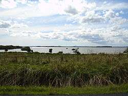
 View from the south-eastern side of the lake | |
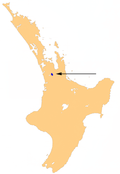
| Location | Waikato District, Waikato Region, North Island |
| Coordinates | 37°26′28.93″S 175°11′55.76″E / 37.4413694°S 175.1988222°ECoordinates: 37°26′28.93″S 175°11′55.76″E / 37.4413694°S 175.1988222°E |
| Basin countries | New Zealand |
| Surface area | 34 km² |

Lake Waikare
Lake Waikare is the largest of several shallow lakes in the upper floodplain of the Waikato River in New Zealand's North Island. It is a riverine lake, located to the east of Te Kauwhata and 40 kilometres north of Hamilton. It covers 34 km².
Due to its shallow nature (its depth is never more than two metres) and the heavy use of fertiliser in the surrounding farming district, the waters of the lake are in poor condition. A 2010 report showed that of all the measured lakes it had the highest trophic level index, a measurement of the amount of pollutants.[1]
References
- ↑ Verburg, P.; Hamill, K.; Unwin, M.; Abell, J. (August 2010). Lake water quality in New Zealand 2010: Status and trends (PDF). Hamilton: National Institute of Water & Atmospheric Research Ltd.
External links
- Lake Waikare at Lake Ecosystem Restoration New Zealand
This article is issued from Wikipedia - version of the 9/4/2015. The text is available under the Creative Commons Attribution/Share Alike but additional terms may apply for the media files.