Laksevåg (municipality)
| Laksevåg kommune | |
|---|---|
| Former Municipality | |
|
View from Lyderhorn | |
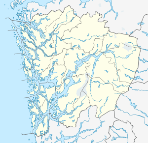
 Laksevåg kommune Location in Hordaland county | |
| Coordinates: 60°22′07″N 05°13′33″E / 60.36861°N 5.22583°ECoordinates: 60°22′07″N 05°13′33″E / 60.36861°N 5.22583°E | |
| Country | Norway |
| Region | Western Norway |
| County | Hordaland |
| District | Midhordland |
| Municipality ID | NO-1248 |
| Adm. Center | Loddefjord |
| Area[1] | |
| • Total | 32.72 km2 (12.63 sq mi) |
| Population (1971) | |
| • Total | 23,350 |
| • Density | 710/km2 (1,800/sq mi) |
| Time zone | CET (UTC+01:00) |
| • Summer (DST) | CEST (UTC+02:00) |
| Created from | Askøy in 1918 |
| Merged into | Bergen in 1972 |
Laksevåg is a former municipality in Hordaland county, Norway. The 32-square-kilometre (12 sq mi) municipality was located on the western part of the Bergen Peninsula. The administrative centre of the municipality was the village of Loddefjord. The municipality, which existed from 1918 until 1972, was a located a short distance west of the city of Bergen, and today it makes up the borough of Laksevåg which is part of the city of Bergen in the municipality of Bergen. The municipality was located along the Byfjorden, north of the Grimstadfjorden, and west of the Fyllingsdalen valley.[1]
History
The municipality of Laksevåg was established on 1 July 1918 when it was separated from the municipality of Askøy. Initially, the municipality had 6,957 residents. On 1 July 1921, the village area of Gyldenpris (population: 1,734) was transferred from Laksevåg to the growing city of Bergen. On 1 January 1972, the city of Bergen was expanded and the four surrounding municipalities of Laksevåg (population: 24,672), Arna, Fana, and Åsane, were all merged with Bergen to form one large urban municipality with over 200,000 residents.[2]
References
- 1 2 Store norske leksikon. "Laksevåg – tidl. kommune" (in Norwegian). Retrieved 2014-09-05.
- ↑ Jukvam, Dag (1999). "Historisk oversikt over endringer i kommune- og fylkesinndelingen" (PDF) (in Norwegian). Statistisk sentralbyrå.
