Lampa Province
For other uses, see Lampa (disambiguation).
| Lampa | ||
|---|---|---|
| Province | ||
|
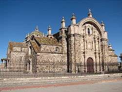
Inmaculada Concepción church in Lampa | ||
| ||
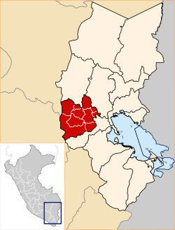 Location of Lampa in the Puno Region | ||
| Country | Peru | |
| Region | Puno | |
| Capital | Lampa | |
| Government | ||
| • Mayor |
Ciriaco Isidro Díaz Arestegui (2007-2010) | |
| Area | ||
| • Total | 5,991.73 km2 (2,313.42 sq mi) | |
| Elevation | 3,892 m (12,769 ft) | |
| Population | ||
| • Total | 48,239 | |
| • Density | 8.1/km2 (21/sq mi) | |
| UBIGEO | 2107 | |
| Website | www.munilampa.gob.pe | |

Lampa province is a province of the Puno region in Peru. Its population is about 50,000. The capital is Lampa.[1]
Geography
The Sillapaka mountain range traverses the province. Some of the highest mountains of the province are listed below:[2]
- Amayani
- Anka Wachana
- Anta Q'awa
- Aqu P'ukru
- Awallani
- Chata
- Chunkara
- Chuqi
- Chuqi Pirwa
- Ch'ulla Rinri
- Hatun Pastu
- Hatun Q'asa
- Illani
- Janq'uyu
- Jayu Laqhi
- Kimsa Chata
- Kimsa Chuta
- Kirani
- Kuntur Ikiña
- Kuntur Puñuna
- Kuntur Sayana
- Kuntur Uma
- Kuntur Wasi
- Kunturi
- Lamparasi
- Luntu Luntuni
- Machu Kunturi
- Mamañawi
- Mich'i Mich'ini
- Pachakutiq
- Pariwana
- Pichaqani
- Puka Punchu
- Pukara
- Phisqa Tira
- P'isqi Punta
- Qaqa Chupa
- Qillqa
- Qillwayuq
- Qullqa Sirka
- Qullqi
- Quylluni
- Q'atawini
- Sayt'u
- T'akra
- Urqun Thaki
- Uturunqani
- Wankara
- Wankarani
- Warmi Sayana
- Waykira
- Willuni
- Wini Wini
- Wira Apachita
- Wisa Wisa
- Yanawara (Ananta)
- Yanawara (Palca-Paratía)
- Yanawara (Paratía)
- Yaritayuq
- Yuraq Apachita
Political division
The province has an area of 5,791.73 square kilometers (2,236.20 sq mi) and is split into ten districts.
Ethnic groups
The people in the province are mainly indigenous citizens of Quechua descent. As of 2007, Quechua was the first language of 74.56% of the population; Spanish of 24.84%; and Aymara of 0.37%.[3]
See also
References
- ↑ (Spanish) Municipalidad Provincial de Lampa, Municipalidad Provincial de Lampa, Retrieved November 8, 2007.
- ↑ escale.minedu.gob.pe - UGEL map of the Lampa Province (Puno Region)
- ↑ 2007 Peru Census, inei.gob.pe INEI, Peru, Censos Nacionales 2007
External links
- (Spanish) Official website
| |
|---|---|
Coordinates: 15°25′S 70°35′W / 15.417°S 70.583°W
This article is issued from Wikipedia - version of the 12/3/2015. The text is available under the Creative Commons Attribution/Share Alike but additional terms may apply for the media files.