Le Neubourg
| Le Neubourg | ||
|---|---|---|
 | ||
| ||
 Le Neubourg | ||
|
Location within Normandy region  Le Neubourg | ||
| Coordinates: 49°08′56″N 0°54′14″E / 49.149°N 0.904°ECoordinates: 49°08′56″N 0°54′14″E / 49.149°N 0.904°E | ||
| Country | France | |
| Region | Normandy | |
| Department | Eure | |
| Arrondissement | Évreux | |
| Canton | Neubourg | |
| Intercommunality | Pays du Neubourg | |
| Government | ||
| • Mayor (2008–2014) | Paul Delachaussée | |
| Area1 | 9.91 km2 (3.83 sq mi) | |
| Population (2008)2 | 4,109 | |
| • Density | 410/km2 (1,100/sq mi) | |
| Time zone | CET (UTC+1) | |
| • Summer (DST) | CEST (UTC+2) | |
| INSEE/Postal code | 27428 / 27110 | |
| Elevation |
110–151 m (361–495 ft) (avg. 134 m or 440 ft) | |
|
1 French Land Register data, which excludes lakes, ponds, glaciers > 1 km² (0.386 sq mi or 247 acres) and river estuaries. 2 Population without double counting: residents of multiple communes (e.g., students and military personnel) only counted once. | ||
.svg.png)
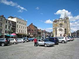
Le Neubourg is a commune in the Eure department in Haute-Normandie in northern France.
History
In the 11th century the manor of Le Neubourg was a subsidiary holding of Roger de Beaumont (d.1094), a principal adviser to William the Conqueror, and feudal lord of Beaumont-le-Roger situated 12 km to the SW. He gave the manor to his second son Henry de Beaumont (c.1048-1119), who was created 1st Earl of Warwick in 1088 and who adopted for himself and his descendants the surname "de Newburgh", the Anglicised adjectival form of his Norman lordship. The name was Latinised to de Novo Burgo, meaning "from the new borough/town".
Population
| Historical population | ||
|---|---|---|
| Year | Pop. | ±% |
| 1962 | 2,835 | — |
| 1968 | 3,132 | +10.5% |
| 1975 | 3,498 | +11.7% |
| 1982 | 3,454 | −1.3% |
| 1990 | 3,639 | +5.4% |
| 1999 | 3,833 | +5.3% |
| 2008 | 4,109 | +7.2% |
See also
References
| Wikimedia Commons has media related to Le Neubourg. |
This article is issued from Wikipedia - version of the 3/15/2016. The text is available under the Creative Commons Attribution/Share Alike but additional terms may apply for the media files.