Le Taillefer
| Le Taillefer | |
|---|---|
 | |
| Highest point | |
| Elevation | 2,857 m (9,373 ft) |
| Prominence | 1,490 m (4,890 ft) [1] |
| Coordinates | 45°02′22″N 5°55′27″E / 45.03944°N 5.92417°ECoordinates: 45°02′22″N 5°55′27″E / 45.03944°N 5.92417°E [2] |
| Geography | |
 Le Taillefer | |
| Parent range | Dauphiné Alps |
| Climbing | |
| First ascent | 1848 by Loupot |
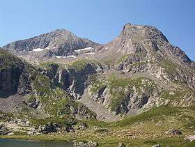
Le Taillefer is a mountain in the Dauphiné Alps, culminating at a height of 2,857 m (9,373 ft). It is located south-east of Grenoble, and is the highest mountain in the Taillefer Massif.
References
- ↑ "Le Taillefer -peakbagger.com". peakbagger.com. Retrieved 18 January 2015.
- ↑ Source : Géoportail avec carte IGN à l'échelle 1:25000
This article is issued from Wikipedia - version of the 11/28/2016. The text is available under the Creative Commons Attribution/Share Alike but additional terms may apply for the media files.