Leaside Bridge
| Leaside Bridge (Confederation Bridge) | |
|---|---|
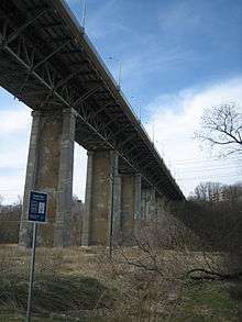 The Leaside Bridge from the ravine below | |
| Coordinates | 43°41′57″N 79°21′01″W / 43.699065°N 79.350356°WCoordinates: 43°41′57″N 79°21′01″W / 43.699065°N 79.350356°W |
| Carries | 6 lanes of vehicular traffic, 2 bike lanes and sidewalks for pedestrian traffic |
| Crosses | Don River |
| Locale | East York, Ontario, Canada |
| Other name(s) | East York-Leaside Viaduct |
| Maintained by | Toronto Transportation Services |
| Characteristics | |
| Design | Truss bridge |
| Total length | 1,443 feet (440 m) |
| Clearance below | Don River Valley and Don Valley Parkway |
| History | |
| Designer | Frank Barber |
| Opened | October 29, 1927 |
| Statistics | |
| Toll | No |

| Wikimedia Commons has media related to Bridges in Toronto. |
The Leaside Bridge, formerly the East York Leaside Viaduct, and officially commemorated as the Confederation Bridge, spans the Don River in the City of Toronto, Ontario. The Truss bridge carrying Millwood Road was built to connect the then Town of Leaside to the then Township of East York, and was completed on October 29, 1927. The construction time of only 10 months was record breaking at the time.[1]
History
During the 1920s, as the new communities surrounding Toronto grew rapidly, several bridges were constructed to overcome the barrier of the Don Valley. Among these were the Vale of Avoca (St. Clair Avenue east of Yonge Street) and the East York – Leaside Viaduct. The town of Leaside, built by Canadian Northern Railway in the late teens and early 1920s, sought to attract investors and homebuyers. A connection over the Don Valley to the town of Todmorden Mills and on to Toronto would provide this.
Sod was turned in mid-December and active construction began in January 1927[2] under the direction of bridge designer Frank Barber. The bridge was rapidly assembled throughout the spring and summer, and inaugurated on October 29 as the Confederation Bridge, in honour of the sixtieth anniversary of that event. The tiled mosaic handrail was designed by New York architect Calude Bragdon with tiles supplied by Italian Mosaic and Tile Company.[3]
In the late 1960s, as the first of numerous plans appeared to extend Leslie Street south of Eglinton, plans were initiated to widen the bridge to support six lanes of traffic. The bridge was closed beginning September 16, 1968, and reopened February 8, 1969.[4] Girders were attached to the sides of the bridge to widen the deck to either side.[3]
Between 2004 and 2006, the bridge was rehabilitated.[3] The second of two contracts to rehabilitate the bridge was awarded in 2005 and included the restoration of the decorative handrail from the original 1927 design.[5][6]
Facts
- Engineer: Frank Barber
- Associate architect: Claude Bragdon
- Height: 45.4 metres or 143.8 feet (12½ storeys)
See also
- Prince Edward Viaduct
- Sewells Road Bridge - another less significant bridge in Toronto built by Frank Barber
References
- ↑ "Built on Raymond Piles". The Leaside Advertiser. October 29, 1927.
- ↑ http://www.nrcresearchpress.com/doi/pdf/10.1139/l84-105
- 1 2 3 http://www.toronto.ca/wes/techservices/involved/transportation/leaside_bridge/pdf/open_house_panels.pdf
- ↑ http://transit.toronto.on.ca/bus/routes/81-thorncliffe.shtml
- ↑ http://www.toronto.ca/wes/techservices/involved/transportation/leaside_bridge/pdf/bridge_conditions.pdf>
- ↑ http://www.toronto.ca/wes/techservices/involved/transportation/leaside_bridge/pdf/railing_landscape.pdf
External links
- Leaside Bridge
- Leaside Bridge Receives Historic Designation
- 2004 to 2006 reconstruction
- Leaside Bridge Rehabilitiation Project
| Crossing the Rouge River | |
|---|---|
| Crossing the Don River | |
| Pedestrian | |
| Other bridges over waterways | |
| Other |
|