Lebowa
Lebowa was a bantustan ("homeland") located in the Transvaal in north eastern South Africa. Seshego initially acted as Lebowa's capital while the purpose-built Lebowakgomo was being constructed. Granted internal self-government on 2 October 1972 and ruled for much of its existence by Cedric Phatudi, Lebowa was reincorporated into South Africa in 1994. It became part of the Limpopo province. The territory was not contiguous, being divided into two major and several minor portions.[3]
Even though Lebowa included swathes of Sekukuniland[4] and was seen as a home for the Northern Sotho speaking tribes such as the Pedi people, it was also home for various non Northern Sotho Speaking tribes, including the Northern Ndebele, Batswana and VaTsonga.
Districts in 1991
Districts of the province and population at the 1991 census.[2]
- Namakgale: 55,441
- Bolobedu: 196,669
- Sekgosese: 124,425
- Bochum: 149,869
- Mokerong: 446,155
- Seshego: 302,676
- Thabamoopo: 353,193
- Nebo: 324,909
- Sekhukhuneland: 404,335
- Naphuno: 167,665
- Mapulaneng: 215,250
See also
References
|
|---|
|
| South Africa | | Nominal independence | |
|---|
| | Self-governance | |
|---|
|
|---|
| | South-West Africa | | Nominal independence | |
|---|
| | Self-governance | |
|---|
|
|---|
| | Leaders and Administrators |
|---|
|
- After Nominal Independence
| | Bophuthatswana  | | Head of State: | |
|---|
| | Administrator: |
- Tjaart Van der Walt and Job Mokgoro (Mar–Apr 1994)
|
|---|
|
|---|
| Bushmanland  | No central government established |
|---|
| Ciskei  | | Head of State: | |
|---|
| | Administrator: |
- Pieter van Rensburg Goosen and Bongani Blessing Finca (Mar–Apr 1994)
|
|---|
|
|---|
| Damaraland  | |
|---|
| Kaokoland .svg.png) | No central government established |
|---|
| Namaland  | | Head of State: |
- Cornelius Cloete (1980–85)
- Daniel Luipert (1985–89)
|
|---|
|
|---|
| Rehoboth  | |
|---|
| Transkei  | | Head of State: | |
|---|
| | Administrator: | |
|---|
|
|---|
| | Tswanaland | |
|---|
| Venda  | |
|---|
| | | East Caprivi  | | Chief Minister: |
- Josiah Moraliswane (Mar–Sept 1976)
- Richard Muhinda Mamili (1976–81)
|
|---|
| | Chairman: |
- Josiah Moraliswane (1981–84)
- H.J. Becker (Jul–Aug 1984)
- F.P.J. Visagie (1984–86)
- I.J. van der Merwe (Mar–Aug 1986)
- A.G. Visser (1986–89)
|
|---|
|
|---|
| Gazankulu  | |
|---|
| Hereroland  | |
|---|
| | KaNgwane | | Chief Minister: | |
|---|
| | Administrator: | |
|---|
|
|---|
| Kavangoland  | |
|---|
| KwaNdebele 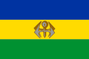 | | Chief Minister: |
- Simon Skosana (1981–86)
- Klaas Mtshiweni (Nov 1986)
- George Majozi Mahlangu (1986–89)
- Jonas Masana Mabena (1989–90)
- James Mahlangu (1990–94)
|
|---|
|
|---|
| KwaZulu  | |
|---|
| Lebowa  | | Chief Minister: |
- Mokgama Maurice Matlala (1972–73)
- Cedric Namedi Phatudi (1973–87)
- Z.T. Seleka (Oct 1987)
- Mogoboya Nelson Ramodike (1987–94)
|
|---|
|
|---|
| Ovamboland  | |
|---|
| QwaQwa  | |
|---|
|
|
Other South African Governments |
|---|
|
|
|
|
Coordinates: 24°18′26″S 29°34′45″E / 24.30722°S 29.57917°E / -24.30722; 29.57917

