List of listed buildings in Rothesay, Bute
This is a list of listed buildings in the parish of Rothesay in Argyll and Bute, Scotland.
List
| Name | Location | Date Listed | Grid Ref. [note 1] | Geo-coordinates | Notes | HB Number [note 2] | Image |
|---|---|---|---|---|---|---|---|
| 57 And 58 Mount Stuart Road, Albany Terrace, Including Boundary Walls And Gatepiers | 55°50′40″N 5°01′48″W / 55.844561°N 5.030003°W | Category B | 44884 | 
| |||
| 37 Victoria Street | 55°50′16″N 5°03′21″W / 55.837713°N 5.055701°W | Category C(S) | 44889 |
| |||
| 63, 65 And 67 Victoria Street | 55°50′16″N 5°03′23″W / 55.837756°N 5.056503°W | Category C(S) | 44892 |
| |||
| 69 And 71 Victoria Street | 55°50′16″N 5°03′25″W / 55.837792°N 5.056841°W | Category C(S) | 44893 |
| |||
| 1-5 (Odd Nos) Watergate And 13 Albert Place Guildford Court Hotel | 55°50′15″N 5°03′11″W / 55.837509°N 5.053049°W | Category C(S) | 44896 |
| |||
| 1 And 1 1/2 York Terrace | 55°50′19″N 5°03′38″W / 55.838489°N 5.060634°W | Category C(S) | 44903 |
| |||
| 35 Craigmore Road, Montford House, Including Boundary Walls And Gatepiers | 55°50′04″N 5°01′34″W / 55.834424°N 5.026211°W | Category B | 44830 |
| |||
| 1, 1A, 2 And 2A Crichton Road Including Boundary Wall And Gatepiers | 55°50′29″N 5°02′28″W / 55.841516°N 5.041173°W | Category C(S) | 44831 |
| |||
| 3, 3A, 4 And 4A Crichton Road Including Boundary Wall And Gatepiers | 55°50′30″N 5°02′27″W / 55.841751°N 5.04076°W | Category C(S) | 44832 |
| |||
| 7 Crichton Road Including Boundary Wall | 55°50′32″N 5°02′24″W / 55.8421°N 5.040101°W | Category C(S) | 44833 |
| |||
| 14 And 15 Crichton Road Including Boundary Wall | 55°50′34″N 5°02′18″W / 55.842792°N 5.038301°W | Category C(S) | 44835 |
| |||
| 23 And 24 Crichton Road, Brighton Terrace, Including Boundary Walls And Gatepiers | 55°50′36″N 5°02′08″W / 55.843217°N 5.03565°W | Category C(S) | 44837 |
| |||
| 27 And 28 Crichton Road, Brighton Terrace, Including Boundary Walls And Gatepiers | 55°50′36″N 5°02′05″W / 55.843221°N 5.034756°W | Category C(S) | 44839 |
| |||
| 31 And 32 Crichton Road, Brighton Terrace, Including Boundary Walls And Gatepiers | 55°50′36″N 5°02′02″W / 55.843401°N 5.034003°W | Category C(S) | 44841 |
| |||
| Minister's Brae, Ashlea, Rowanlea, Beechlea, Elmlea And Oaklea Including Boundary Walls | 55°50′01″N 5°03′16″W / 55.833699°N 5.054443°W | Category C(S) | 44862 |
| |||
| 7 And 9 Mount Pleasant Road, Eaglesham Lodge, Including Boundary Wall And Gatepiers | 55°50′07″N 5°03′02″W / 55.835276°N 5.050669°W | Category B | 44870 |
| |||
| 19-27 Mount Stuart Road, Wimbleton, Including Boundary Walls And Gatepiers | 55°50′36″N 5°02′25″W / 55.84323°N 5.040189°W | Category B | 44873 |
| |||
| 41 And 42 Mount Stuart Road, Elysium Terrace, Including Boundary Walls And Gatepiers | 55°50′38″N 5°02′14″W / 55.843988°N 5.03718°W | Category B | 44876 |
| |||
| 53 And 54 Mount Stuart Road, Royal Terrace, Including Boundary Walls And Gatepiers | 55°50′39″N 5°02′04″W / 55.844225°N 5.034499°W | Category B | 44882 |
| |||
| 1 Ardbeg Road, Woodside, Including Outbuilding, Boundary Wall And Gatepiers | 55°50′51″N 5°03′49″W / 55.847566°N 5.063633°W | Category C(S) | 44773 |
| |||
| 11 Argyle Place Including Boundary Wall And Gatepiers | 55°50′32″N 5°03′46″W / 55.842238°N 5.062782°W | Category C(S) | 44786 |
| |||
| 41 Argyle Street Including Boundary Wall, Gatepiers And Railings | 55°50′25″N 5°03′40″W / 55.84016°N 5.061037°W | Category C(S) | 44790 |
| |||
| Argyle Street, 1-8 (Inclusive Nos) Grand Marine Court, Including Porch, Boundary Wall, Gatepiers And Railings | 55°50′25″N 5°03′40″W / 55.840274°N 5.061142°W | Category C(S) | 44791 |
| |||
| 14 And 14A Battery Place Including Boundary Wall | 55°50′23″N 5°02′54″W / 55.839623°N 5.048278°W | Category C(S) | 44802 |
| |||
| 10 And 12 Bishop Street, Post Office | 55°50′13″N 5°03′09″W / 55.837074°N 5.05244°W | Category B | 44808 |
| |||
| 8 And 9 Bishop Terrace Including Dovecot, Coach-House, Boundary Wall And Gatepiers | 55°50′14″N 5°03′00″W / 55.837263°N 5.049915°W | Category C(S) | 44811 |
| |||
| Bishop Terrace, Beechwood Hotel Including Boundary Wall And Gatepiers | 55°50′18″N 5°02′55″W / 55.838224°N 5.048504°W | Category B | 44812 |
| |||
| Bridgend Street, St Andrew's Church Hall, Including Piers (Formerly Bridgend Church) | 55°50′14″N 5°03′29″W / 55.837189°N 5.057944°W | Category B | 44815 |
| |||
| 8 Columshill Place | 55°50′08″N 5°03′34″W / 55.835492°N 5.059312°W | Category C(S) | 44820 |
| |||
| 26 And 28 Columshill Street | 55°50′08″N 5°03′32″W / 55.835657°N 5.058814°W | Category C(S) | 40481 |
| |||
| High Kirk Of Rothesay, Ruin Of St Mary's Chapel | 55°49′43″N 5°03′25″W / 55.828509°N 5.057071°W | Category B | 40447 |
| |||
| Ardencraig Road, Tor House, Including Boundary Wall, Gatepiers And Gates | 55°50′28″N 5°01′37″W / 55.84102°N 5.027012°W | Category A | 40468 |
| |||
| 59 And 60 Mount Stuart Road, Albany Terrace, Including Boundary Walls And Gatepiers | 55°50′40″N 5°01′47″W / 55.844511°N 5.029808°W | Category B | 44885 |
| |||
| Stuart Street, Bute Museum | 55°50′09″N 5°03′18″W / 55.835872°N 5.054885°W | Category B | 44888 |
| |||
| 39 And 41 Victoria Street | 55°50′16″N 5°03′21″W / 55.837743°N 5.055943°W | Category B | 44890 |
| |||
| Westland Road, Ivybank, Including Boundary Walls And Gatepiers | 55°50′15″N 5°03′39″W / 55.837531°N 5.060846°W | Category B | 44899 |
| |||
| 2,4,6 And 8 West Princes Street | 55°50′14″N 5°03′11″W / 55.837304°N 5.052985°W | Category C(S) | 44902 |
| |||
| 24 Craigmore Road, Craigend Retirement Home Including Outbuildings, Boundary Wall And Gatepiers | 55°50′12″N 5°01′33″W / 55.836734°N 5.025864°W | Category C(S) | 44827 |
| |||
| 27 And 28 Craigmore Road, Orcadia, Including Boundary Wall And Gatepiers | 55°50′09″N 5°01′33″W / 55.835963°N 5.025756°W | Category B | 44829 |
| |||
| 10 And 11 Crichton Road Including Boundary Wall | 55°50′33″N 5°02′21″W / 55.842491°N 5.039172°W | Category C(S) | 44834 |
| |||
| 25 And 26 Crichton Road, Brighton Terrace, Including Boundary Walls And Gatepiers | 55°50′36″N 5°02′07″W / 55.843238°N 5.035157°W | Category C(S) | 44838 |
| |||
| 33 And 34 Crichton Road, Brighton Terrace, Including Boundary Walls And Gatepiers | 55°50′36″N 5°02′01″W / 55.843439°N 5.033575°W | Category C(S) | 44842 |
| |||
| 1-3 (Inclusive Nos) East Princes Street, Albert Mansions | 55°50′14″N 5°03′06″W / 55.837282°N 5.051673°W | Category C(S) | 44845 |
| |||
| Minister's Brae, Hewison House Including Outbuildings, Boundary Walls And Gatepiers | 55°50′01″N 5°03′08″W / 55.833726°N 5.052257°W | Category C(S) | 44864 |
| |||
| 1, 3 And 5 Montague Street | 55°50′14″N 5°03′12″W / 55.837167°N 5.053406°W | Category C(S) | 44865 |
| |||
| 64, 66 And 68 Montague Street | 55°50′15″N 5°03′21″W / 55.837562°N 5.055961°W | Category C(S) | 44868 |
| |||
| 30-34 (Even Nos) Mount Pleasant Road Including Boundary Wall And Gatepiers | 55°50′04″N 5°03′08″W / 55.834471°N 5.0523°W | Category C(S) | 44871 |
| |||
| 43 And 44 Mount Stuart Road, Elysium Terrace, Including Boundary Walls And Gatepiers | 55°50′39″N 5°02′12″W / 55.844052°N 5.036786°W | Category B | 44877 |
| |||
| Academy Road, 1-6 (Inclusive Nos) Academy Terrace | 55°50′22″N 5°03′43″W / 55.839582°N 5.06187°W | Category C(S) | 44768 |
| |||
| 14 Ardbeg Road, Tigh-Na-Mara, Including Outbuilding, Boundary Wall And Gatepier | 55°51′00″N 5°03′49″W / 55.849905°N 5.063562°W | Category B | 44774 |
| |||
| Barone Road, Bute Fabrics Including Boundary Walls And Gatepiers | 55°50′02″N 5°03′31″W / 55.833883°N 5.058595°W | Category B | 44799 |
| |||
| 28 Battery Place, Alamein House Including Boundary Wall | 55°50′26″N 5°02′48″W / 55.840688°N 5.046668°W | Category C(S) | 44806 |
| |||
| 38 Bridge Street, Mavisbank, Including Boundary Walls | 55°50′16″N 5°03′37″W / 55.837889°N 5.060188°W | Category B | 44813 |
| |||
| 7 Craigmore Road Including Boundary Wall And Gatepiers | 55°50′34″N 5°01′31″W / 55.842886°N 5.025367°W | Category C(S) | 44822 |
| |||
| 15 Craigmore Road, Glencraig, Including Outbuildings, Boundary Walls And Gatepiers | 55°50′29″N 5°01′29″W / 55.841353°N 5.024833°W | Category C(S) | 44823 |
| |||
| 14-26 (Even Nos) Russell Street And 19, 21, 23 Mill Street | 55°50′06″N 5°03′20″W / 55.835038°N 5.055539°W | Category B | 40485 |
| |||
| 19-27 (Odd Nos) Bishop Street | 55°50′12″N 5°03′07″W / 55.836727°N 5.051949°W | Category C(S) | 40463 |
| |||
| Ardencraig Road, Ardencraig House, Including Gatepiers | 55°50′17″N 5°01′37″W / 55.837955°N 5.026997°W | Category B | 40467 |
| |||
| 33 And 34 Mount Stuart Road, Elysium Terrace, Including Boundary Walls And Gatepiers | 55°50′37″N 5°02′19″W / 55.843637°N 5.038655°W | Category B | 40470 |
| |||
| 6 Columshill Place | 55°50′08″N 5°03′33″W / 55.835504°N 5.059202°W | Category C(S) | 40479 |
| |||
| Rothesay Castle And Chapel | 55°50′11″N 5°03′18″W / 55.836418°N 5.054992°W | Category A | 44887 |
| |||
| Victoria Street, St Paul's Episcopal Church Including Boundary Wall | 55°50′16″N 5°03′25″W / 55.837769°N 5.057063°W | Category B | 44895 |
| |||
| Westland Road, Chapelhill Villa, Including Outbuilding, Boundary Wall, Gatepiers And Gate | 55°50′18″N 5°03′43″W / 55.838387°N 5.061824°W | Category C(S) | 44898 |
| |||
| 23 Craigmore Road, Craigend House, Including Boundary Wall And Gatepiers | 55°50′15″N 5°01′31″W / 55.837429°N 5.025374°W | Category B | 44826 |
| |||
| 19, 20 And 21 Crichton Road Including Boundary Wall And Gatepiers | 55°50′35″N 5°02′12″W / 55.84309°N 5.036791°W | Category C(S) | 44836 |
| |||
| 45, 46 And 47 Crichton Road Including Boundary Wall And Gatepiers | 55°50′36″N 5°01′49″W / 55.843257°N 5.030365°W | Category C(S) | 44843 |
| |||
| 48 And 49 Crichton Road, Craigmore Hotel, Including Boundary Wall | 55°50′36″N 5°01′48″W / 55.843332°N 5.029876°W | Category B | 44844 |
| |||
| 1-5 (Inclusive Nos) John Street | 55°50′08″N 5°03′24″W / 55.835678°N 5.056532°W | Category C(S) | 44855 |
| |||
| 21, 23 And 25 Montague Street | 55°50′14″N 5°03′15″W / 55.837186°N 5.054094°W | Category C(S) | 44866 |
| |||
| 60 And 62 Montague Street And 3, 5 And 7 Tower Street | 55°50′15″N 5°03′20″W / 55.837596°N 5.055692°W | Category B | 44867 |
| |||
| 9, 10 And 10A Mount Stuart Road, Glenfaulds, Including Boundary Wall And Gatepiers | 55°50′33″N 5°02′33″W / 55.842421°N 5.042362°W | Category B | 44872 |
| |||
| 37, 38 And 39 Mount Stuart Road, Elysium Terrace, Including Boundary Walls And Gatepiers | 55°50′38″N 5°02′16″W / 55.843826°N 5.037903°W | Category B | 44875 |
| |||
| 49 And 50 Mount Stuart Road, Royal Terrace, Including Boundary Walls And Gatepiers | 55°50′39″N 5°02′08″W / 55.844201°N 5.035471°W | Category B | 44880 |
| |||
| 1 Alma Terrace Including Boundary Wall And Gatepiers | 55°50′10″N 5°03′42″W / 55.836099°N 5.061676°W | Category C(S) | 44772 |
| |||
| 7,8 And 9 Argyle Street | 55°50′18″N 5°03′30″W / 55.838375°N 5.058357°W | Category C(S) | 44789 |
| |||
| 15 And 16 Battery Place, Marlborough, Including Boundary Wall | 55°50′23″N 5°02′53″W / 55.839689°N 5.048156°W | Category C(S) | 44803 |
| |||
| 21 And 22 Battery Place Including Boundary Wall | 55°50′25″N 5°02′50″W / 55.840276°N 5.047307°W | Category C(S) | 44805 |
| |||
| 6,8,10 And 12 Bridgend Street (Former Bridgend Church Hall) | 55°50′14″N 5°03′28″W / 55.8371°N 5.057905°W | Category C(S) | 44814 |
| |||
| 16 And 18 Columshill Street | 55°50′09″N 5°03′32″W / 55.835909°N 5.058818°W | Category C(S) | 44821 |
| |||
| Castle Street, Trinity Church, Including Hall, Boundary Wall, Gatepiers, Lamps And Railings | 55°50′09″N 5°03′10″W / 55.835778°N 5.052881°W | Category B | 43854 |
| |||
| 17, 19 And 21 Russell Street Including Boundary Wall To Union Street (Colbeck Place) | 55°50′05″N 5°03′22″W / 55.834833°N 5.056194°W | Category C(S) | 40484 |
| |||
| High Kirk Of Rothesay Including Outbuilding, Graveyard, Boundary Wall And Gatepiers | 55°49′43″N 5°03′26″W / 55.82862°N 5.057319°W | Category B | 40445 |
| |||
| High Kirk Of Rothesay, Bute Mausoleum | 55°49′43″N 5°03′28″W / 55.828672°N 5.057738°W | Category A | 40446 |
| |||
| Columshill Street, St Andrew's Roman Catholic Church , Including Priest's House, Boundary Wall And Piers | 55°50′10″N 5°03′30″W / 55.836234°N 5.058396°W | Category A | 40451 |
| |||
| 55, 57 And 59 High Street Bute Estate Office Including Outbuilding | 55°50′10″N 5°03′14″W / 55.835984°N 5.054°W | Category A | 40456 |
| |||
| Battery Place And Glenburn Road, Beattie Court (Former Aquarium) Including Stairs, Boundary Wall And Piers | 55°50′28″N 5°02′45″W / 55.841185°N 5.045813°W | Category B | 40472 |
| |||
| 4 Columshill Place | 55°50′08″N 5°03′32″W / 55.835527°N 5.059012°W | Category C(S) | 40478 |
| |||
| Mount Stuart Road, Sewage Screening Chamber And Public Convenience | 55°50′37″N 5°01′30″W / 55.843545°N 5.024891°W | Category B | 44886 |
| |||
| Well Park Road, Rock Villa Including Boundary Wall And Gatepiers | 55°50′34″N 5°01′36″W / 55.84278°N 5.026749°W | Category C(S) | 44897 |
| |||
| 16 Craigmore Road, Madras House, Including Boundary Walls And Gatepiers | 55°50′28″N 5°01′29″W / 55.841111°N 5.024782°W | Category C(S) | 44824 |
| |||
| 29 And 30 Crichton Road, Brighton Terrace, Including Boundary Walls And Gatepiers | 55°50′36″N 5°02′04″W / 55.843327°N 5.034445°W | Category C(S) | 44840 |
| |||
| 43 And 44 East Princes Street, Including Boundary Wall | 55°50′19″N 5°02′59″W / 55.83868°N 5.049674°W | Category C(S) | 44847 |
| |||
| Glenburn Hotel, Glenfaulds Cottage | 55°50′31″N 5°02′30″W / 55.841963°N 5.04164°W | Category B | 44850 |
| |||
| 2 Marine Place, Moss Bank, Including Outbuilding, Boundary Walls And Gatepiers | 55°51′19″N 5°03′46″W / 55.855252°N 5.062896°W | Category C(S) | 44857 |
| |||
| 19 Marine Place, Frolin, Including Outbuilding And Boundary Wall | 55°51′30″N 5°03′47″W / 55.858267°N 5.063117°W | Category C(S) | 44860 |
| |||
| 45 And 46 Mount Stuart Road, Royal Terrace, Including Boundary Walls And Gatepiers | 55°50′39″N 5°02′10″W / 55.84412°N 5.0362°W | Category B | 44878 |
| |||
| 47 And 48 Mount Stuart Road, Royal Terrace, Including Boundary Walls And Gatepiers | 55°50′39″N 5°02′09″W / 55.844159°N 5.035724°W | Category B | 44879 |
| |||
| 51 And 52 Mount Stuart Road, Royal Terrace, Including Boundary Walls And Gatepiers | 55°50′39″N 5°02′06″W / 55.844169°N 5.034926°W | Category B | 44881 |
| |||
| 55 And 56 Mount Stuart Road, Albany Terrace, Including Boundary Walls And Gatepiers | 55°50′40″N 5°01′49″W / 55.844498°N 5.030334°W | Category B | 44883 |
| |||
| Academy Road, Rothesay Academy Including Retaining Wall, Boundary Wall And Gatepiers | 55°50′20″N 5°03′46″W / 55.838833°N 5.062706°W | Category B | 44767 |
| |||
| 20 And 21 Ardbeg Road Including Outbuilding, Boundary Wall And Piers | 55°51′02″N 5°03′47″W / 55.85069°N 5.063064°W | Category C(S) | 44776 |
| |||
| 53 Ardbeg Road Including Outbuilding, Boundary Wall And Piers | 55°51′15″N 5°03′47″W / 55.854172°N 5.062971°W | Category C(S) | 44778 |
| |||
| 63 Ardbeg Road Including Outbuilding, Boundary Wall And Gatepiers | 55°51′19″N 5°03′50″W / 55.855245°N 5.063886°W | Category C(S) | 44779 |
| |||
| Ardbeg Road, Ardbeg Baptist Church Including Boundary Wall, Gatepiers And Railings | 55°50′56″N 5°03′49″W / 55.848981°N 5.063473°W | Category B | 44780 |
| |||
| 9 And 10 Battery Place Including Boundary Wall | 55°50′22″N 5°02′56″W / 55.839324°N 5.04875°W | Category C(S) | 44800 |
| |||
| 5 Bishop Terrace Including Boundary Wall And Gatepiers | 55°50′12″N 5°03′02″W / 55.836782°N 5.050468°W | Category C(S) | 44810 |
| |||
| 7 And 9 Castle Street, Bute Housing Association | 55°50′11″N 5°03′11″W / 55.836375°N 5.053088°W | Category B | 44816 |
| |||
| 34 Castle Street, Including Boundary Wall And Gatepiers | 55°50′09″N 5°03′08″W / 55.835931°N 5.052143°W | Category C(S) | 44818 |
| |||
| 61 And 67 High Street Including Rear Outbuilding (No 65) | 55°50′09″N 5°03′15″W / 55.835721°N 5.054075°W | Category B | 40457 |
| |||
| 3 Stuart Street | 55°50′09″N 5°03′16″W / 55.835926°N 5.054506°W | Category B | 40459 |
| |||
| 73 Victoria Street | 55°50′16″N 5°03′25″W / 55.837834°N 5.056956°W | Category C(S) | 44894 |
| |||
| 22 Craigmore Road, Craigmore House, Including Sundial, Boundary Wall And Gatepiers | 55°50′17″N 5°01′31″W / 55.838115°N 5.025252°W | Category C(S) | 44825 |
| |||
| 90 High Street, Including Boundary Wall | 55°50′01″N 5°03′21″W / 55.833694°N 5.055721°W | Category C(S) | 44852 |
| |||
| High Street, Former United Free Church, Including Boundary Wall | 55°50′07″N 5°03′14″W / 55.83541°N 5.053955°W | Category C(S) | 44853 |
| |||
| 7 Marine Place, Millerston House, Including Outbuilding And Boundary Wall | 55°51′21″N 5°03′46″W / 55.855938°N 5.062774°W | Category C(S) | 44858 |
| |||
| 22 And 22A Marine Place Including Outbuilding And Boundary Wall | 55°51′30″N 5°03′48″W / 55.85829°N 5.063295°W | Category C(S) | 44861 |
| |||
| 70, 72 And 74 Montague Street | 55°50′16″N 5°03′22″W / 55.837658°N 5.056096°W | Category C(S) | 44869 |
| |||
| 10-12 (Inclusive Nos) Albert Place | 55°50′15″N 5°03′10″W / 55.837541°N 5.052844°W | Category C(S) | 44771 |
| |||
| 14 Argyle Place Including Boundary Wall And Gatepiers | 55°50′33″N 5°03′46″W / 55.842561°N 5.062808°W | Category C(S) | 44787 |
| |||
| 26 Argyle Place, Including Boundary Wall And Gatepiers | 55°50′37″N 5°03′47″W / 55.84349°N 5.063057°W | Category B | 44788 |
| |||
| 33 And 35 Argyle Terrace Including Outbuilding And Boundary Wall | 55°50′33″N 5°03′51″W / 55.842416°N 5.064282°W | Category B | 44797 |
| |||
| 26 Castle Street | 55°50′10″N 5°03′10″W / 55.836076°N 5.052841°W | Category C(S) | 44817 |
| |||
| 30 Columshill Street | 55°50′08″N 5°03′32″W / 55.835595°N 5.058777°W | Category C(S) | 40482 |
| |||
| West Pier, Public Convenience | 55°50′11″N 5°03′18″W / 55.836418°N 5.054992°W | Category B | 40448 |
| |||
| 2 Union Street (Colbeck Place) Including Boundary Wall | 55°50′05″N 5°03′23″W / 55.834747°N 5.056379°W | Category B | 40460 |
| |||
| Ardencraig Road, Rockhill Castle, Including Boundary Walls, Terrace Walls And Verandah | 55°50′26″N 5°01′34″W / 55.840665°N 5.026121°W | Category B | 40469 |
| |||
| 3-9 (Odd Nos) Columshill Place | 55°50′07″N 5°03′34″W / 55.835214°N 5.059307°W | Category B | 40477 |
| |||
| West Pier, Cabbies' Shelter | 55°50′18″N 5°03′17″W / 55.838217°N 5.05459°W | Category C(S) | 44900 |
| |||
| Glenburn Road, East Firwood And West Firwood | 55°50′26″N 5°02′34″W / 55.840477°N 5.042818°W | Category B | 44851 |
| |||
| Inner Harbour, Former Weighing House Including Weigh Bridge | 55°50′16″N 5°03′13″W / 55.837824°N 5.053745°W | Category C(S) | 44854 |
| |||
| 8 Marine Place, Aros-Na-Mara Including Boundary Wall And Gatepiers | 55°51′22″N 5°03′46″W / 55.856134°N 5.06287°W | Category C(S) | 44859 |
| |||
| 35 And 36 Mount Stuart Road, Elysium Terrace, Including Boundary Walls And Gatepiers | 55°50′38″N 5°02′17″W / 55.843794°N 5.038108°W | Category B | 44874 |
| |||
| Albert Place And West Princes Street, Former Royal Hotel | 55°50′15″N 5°03′08″W / 55.837529°N 5.052236°W | Category B | 44769 |
| |||
| 18, 18A And 19 Ardbeg Road Including Boundary Wall | 55°51′02″N 5°03′47″W / 55.850581°N 5.063104°W | Category C(S) | 44775 |
| |||
| 24 And 25 Ardbeg Road Including Boundary Wall | 55°51′04″N 5°03′47″W / 55.851049°N 5.063077°W | Category C(S) | 44777 |
| |||
| Ardencraig Road, Ardencraig Lodge | 55°50′19″N 5°01′35″W / 55.838477°N 5.026271°W | Category C(S) | 44783 |
| |||
| 1 Argyle Place Including Boundary Wall | 55°50′28″N 5°03′43″W / 55.841143°N 5.062009°W | Category C(S) | 44784 |
| |||
| Argyle Street, West Church | 55°50′20″N 5°03′35″W / 55.838796°N 5.059844°W | Category B | 44792 |
| |||
| 31 Argyle Terrace Including Boundary Wall And Gatepiers | 55°50′32″N 5°03′51″W / 55.842139°N 5.064229°W | Category C(S) | 44793 |
| |||
| Barone Road, Barone Cottage | 55°49′50″N 5°04′07″W / 55.830439°N 5.068738°W | Category C(S) | 44798 |
| |||
| Argyle Street, Rothesay Pavilion Including House At Rear And Boundary Wall | 55°50′25″N 5°03′43″W / 55.840323°N 5.062073°W | Category A | 40452 |
| |||
| Castle Street, County Hall, Including Former Prison Cells | 55°50′12″N 5°03′14″W / 55.836546°N 5.053804°W | Category B | 40453 |
| |||
| Victoria Street, The Winter Gardens | 55°50′18″N 5°03′20″W / 55.838351°N 5.055687°W | Category A | 40454 | 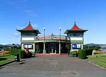
| |||
| 19-25 (Inclusive Nos) East Princes Street, Duncan's Halls | 55°50′16″N 5°03′04″W / 55.837726°N 5.051165°W | Category B | 44846 |
| |||
| Eastlands Road, Edgehill And Hillpark, Including Outbuilding, Boundary Wall And Gatepiers | 55°50′31″N 5°01′39″W / 55.84206°N 5.027508°W | Category C(S) | 44848 |
| |||
| 4 King Street | 55°50′13″N 5°03′22″W / 55.836874°N 5.056178°W | Category B | 44856 |
| |||
| Minister's Brae, Marionslea Including Boundary Wall And Gatepiers | 55°50′01″N 5°03′14″W / 55.833677°N 5.053883°W | Category B | 44863 |
| |||
| 11 And 11A Battery Place, Including Boundary Wall | 55°50′22″N 5°02′55″W / 55.839427°N 5.048582°W | Category C(S) | 44801 |
| |||
| 13 And 15 Bishop Street | 55°50′13″N 5°03′07″W / 55.836962°N 5.051888°W | Category C(S) | 44807 |
| |||
| 36 And 38 Castle Street | 55°50′09″N 5°03′07″W / 55.835889°N 5.052011°W | Category C(S) | 44819 |
| |||
| 20, 22 And 24 Columshill Street | 55°50′09″N 5°03′32″W / 55.835792°N 5.058809°W | Category C(S) | 40480 |
| |||
| 43-55 (Odd Nos) Victoria Street, Rothesay Victoria Hotel, Including Lampstands And Plaque | 55°50′16″N 5°03′23″W / 55.837803°N 5.056395°W | Category B | 44891 |
| |||
| Glenburn Road, Glenburn Hotel Including Terrace Wall, Boundary Walls, Gatepiers And Cottages | 55°50′30″N 5°02′33″W / 55.841562°N 5.042567°W | Category B | 44849 |
| |||
| 7-9 (Inclusive Nos) Albert Place And 5-9 (Odd Nos) West Princes Street | 55°50′15″N 5°03′09″W / 55.837528°N 5.052635°W | Category C(S) | 44770 |
| |||
| 2 Argyle Place Including Boundary Wall | 55°50′28″N 5°03′44″W / 55.841248°N 5.062113°W | Category C(S) | 44785 |
| |||
| 20 Battery Place, Glendale | 55°50′25″N 5°02′51″W / 55.840191°N 5.047476°W | Category B | 44804 |
| |||
| 4 Bishop Terrace Including Boundary Wall And Gatepiers | 55°50′12″N 5°03′02″W / 55.836561°N 5.050674°W | Category C(S) | 44809 |
| |||
| Chapelhill Road, Free Church Of Scotland, Including Boundary Walls | 55°50′19″N 5°03′40″W / 55.838674°N 5.061144°W | Category B | 43855 |
| |||
| 32 Columshill Street And 2 Columshill Place | 55°50′08″N 5°03′32″W / 55.835532°N 5.058788°W | Category B | 40483 |
| |||
| 51 And 53 High Street | 55°50′10″N 5°03′14″W / 55.836067°N 5.05391°W | Category B | 40455 |
| |||
| Market Cross, High Street | 55°50′09″N 5°03′16″W / 55.835939°N 5.054364°W | Category C(S) | 40458 |
|
Key
The scheme for classifying buildings in Scotland is:
- Category A: "buildings of national or international importance, either architectural or historic, or fine little-altered examples of some particular period, style or building type."[1]
- Category B: "buildings of regional or more than local importance, or major examples of some particular period, style or building type which may have been altered."[1]
- Category C(S): "buildings of local importance, lesser examples of any period, style, or building type, as originally constructed or moderately altered; and simple traditional buildings which group well with others in categories A and B."[1]
There are approximately 47,400 listed buildings in Scotland. Of these, around 8 per cent (some 3,800) are Category A, and 51 per cent (24,000) are Category B, with the rest listed at Category C(s).[2]
See also
Notes
- ↑ Sometimes known as OSGB36, the grid reference (where provided) is based on the British national grid reference system used by the Ordnance Survey.
• "Guide to National Grid". Ordnance Survey. Retrieved 2007-12-12.
• "Get-a-map". Ordnance Survey. Retrieved 2007-12-17. - ↑ The "HB Number" is a unique number assigned to each listed building by Historic Scotland.
References
- All entries, addresses and coordinates are based on data from Historic Scotland. This data falls under the Open Government Licence
- 1 2 3 "What is Listing?". Historic Scotland. Retrieved 2010-07-06.
- ↑ Guide to the Protection of Scotland’s Listed Buildings (PDF). Historic Scotland. 2009. p. 17. ISBN 978-1-84917-013-0. Retrieved 2010-07-06.
This article is issued from Wikipedia - version of the 10/15/2016. The text is available under the Creative Commons Attribution/Share Alike but additional terms may apply for the media files.