List of peaks in Rocky Mountain National Park
Main articles: List of mountain peaks of the Rocky Mountains and List of mountain peaks of Colorado
| Map |
|---|
| Create a map of all Rocky Mountain National Park peak coordinates using this OpenStreetMap (OSM) link |
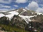
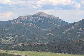
The list of peaks in Rocky Mountain National Park includes the following:[1]

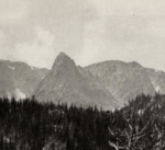
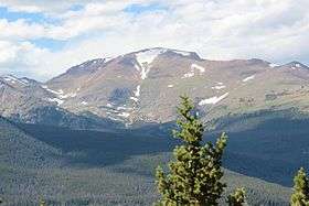
.jpg)
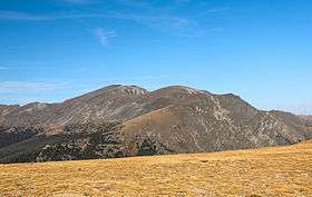

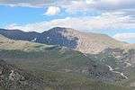
_July_2016.jpg)
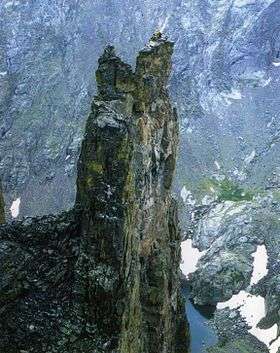


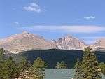
_July_2016.jpg)


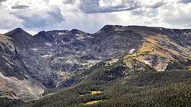
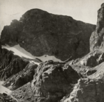
_viewed_from_Trail_Ridge_Road.jpg)
References
- ↑ "Rocky Mountain National Park - Trailheads and Peaks". Summit Post. Retrieved October 31, 2016.
- ↑ "Flattop Mountain". Geographic Names Information System. United States Geological Survey. October 13, 1978. Retrieved November 1, 2016.
- ↑ "Hallett Peak". Geographic Names Information System. United States Geological Survey. October 13, 1978. Retrieved November 1, 2016.
- ↑ "Hayden Spire". Geographic Names Information System. United States Geological Survey. October 13, 1978. Retrieved November 1, 2016.
- ↑ "Knobtop Mountain". Geographic Names Information System. United States Geological Survey. October 13, 1978. Retrieved November 1, 2016.
- ↑ "Little Matterhorn". Geographic Names Information System. United States Geological Survey. October 13, 1978. Retrieved November 1, 2016.
- ↑ "Notchtop Mountain". Geographic Names Information System. United States Geological Survey. October 13, 1978. Retrieved November 1, 2016.
- ↑ "Ptarmigan Point". Geographic Names Information System. United States Geological Survey. October 13, 1978. Retrieved November 1, 2016.
- ↑ "Snowdrift Peak". Geographic Names Information System. United States Geological Survey. October 13, 1978. Retrieved November 1, 2016.
- ↑ "Desolation Peaks". Geographic Names Information System. United States Geological Survey. October 13, 1978. Retrieved November 1, 2016.
- ↑ "Mount Chapin". Geographic Names Information System. United States Geological Survey. October 13, 1978. Retrieved November 1, 2016.
- ↑ "Mount Chiquita". Geographic Names Information System. United States Geological Survey. October 13, 1978. Retrieved November 1, 2016.
- ↑ "Ypsilon Mountain". Geographic Names Information System. United States Geological Survey. October 13, 1978. Retrieved November 1, 2016.
- ↑ "Howard Mountain". Geographic Names Information System. United States Geological Survey. October 13, 1978. Retrieved November 1, 2016.
- ↑ "Lead Mountain". Geographic Names Information System. United States Geological Survey. October 13, 1978. Retrieved November 1, 2016.
- ↑ "Lulu Mountain". Geographic Names Information System. United States Geological Survey. October 13, 1978. Retrieved November 1, 2016.
- ↑ "Mount Cirrus". Geographic Names Information System. United States Geological Survey. October 13, 1978. Retrieved November 3, 2016.
- ↑ "Mount Cumulus". Geographic Names Information System. United States Geological Survey. October 13, 1978. Retrieved November 3, 2016.
- ↑ "Mount Nimbus". Geographic Names Information System. United States Geological Survey. October 13, 1978. Retrieved November 7, 2016.
- ↑ "Dark Mountain". Geographic Names Information System. United States Geological Survey. October 13, 1978. Retrieved November 7, 2016.
- ↑ "Comanche Peak". Geographic Names Information System. United States Geological Survey. October 13, 1978. Retrieved November 7, 2016.
- ↑ "Fall Mountain". Geographic Names Information System. United States Geological Survey. October 13, 1978. Retrieved November 7, 2016.
- ↑ "Stones Peak". Geographic Names Information System. United States Geological Survey. October 13, 1978. Retrieved November 7, 2016.
- ↑ "Arrowhead". Geographic Names Information System. United States Geological Survey. October 13, 1978. Retrieved November 7, 2016.
- ↑ "Chiefs Head Peak". Geographic Names Information System. United States Geological Survey. October 13, 1978. Retrieved November 7, 2016.
- ↑ "Half Mountain". Geographic Names Information System. United States Geological Survey. October 13, 1978. Retrieved November 7, 2016.
- ↑ "McHenrys Peak". Geographic Names Information System. United States Geological Survey. October 13, 1978. Retrieved November 7, 2016.
- ↑ "Otis Peak". Geographic Names Information System. United States Geological Survey. October 13, 1978. Retrieved November 7, 2016.
- ↑ "Pagoda Mountain". Geographic Names Information System. United States Geological Survey. October 13, 1978. Retrieved November 7, 2016.
- ↑ "Petit Grepon", Google maps, retrieved November 10, 2016
- ↑ "Powell Peak". Geographic Names Information System. United States Geological Survey. October 13, 1978. Retrieved November 8, 2016.
- ↑ "The Sharkstooth". Geographic Names Information System. United States Geological Survey. October 13, 1978. Retrieved November 8, 2016.
- ↑ "The Spearhead". Geographic Names Information System. United States Geological Survey. October 13, 1978. Retrieved November 8, 2016.
- ↑ "Taylor Peak". Geographic Names Information System. United States Geological Survey. October 13, 1978. Retrieved November 8, 2016.
- ↑ "Thatchtop". Geographic Names Information System. United States Geological Survey. October 13, 1978. Retrieved November 8, 2016.
- ↑ "Nakai Peak". Geographic Names Information System. United States Geological Survey. October 13, 1978. Retrieved November 8, 2016.
- ↑ "Sprague Mountain". Geographic Names Information System. United States Geological Survey. October 13, 1978. Retrieved November 8, 2016.
- ↑ "Mount Richthofen". Geographic Names Information System. United States Geological Survey. October 13, 1978. Retrieved November 8, 2016.
- ↑ "Static Peak". Geographic Names Information System. United States Geological Survey. October 13, 1978. Retrieved November 8, 2016.
- ↑ "Tepee Mountain". Geographic Names Information System. United States Geological Survey. October 13, 1978. Retrieved November 8, 2016.
- ↑ "Fairchild Mountain". Geographic Names Information System. United States Geological Survey. October 13, 1978. Retrieved November 9, 2016.
- ↑ "Hagues Peak". Geographic Names Information System. United States Geological Survey. October 13, 1978. Retrieved November 9, 2016.
- ↑ "Mummy Mountain". Geographic Names Information System. United States Geological Survey. October 13, 1978. Retrieved November 9, 2016.
- ↑ "Rowe Peak". Geographic Names Information System. United States Geological Survey. October 13, 1978. Retrieved November 9, 2016.
- ↑ "Estes Cone". Geographic Names Information System. United States Geological Survey. October 13, 1978. Retrieved November 10, 2016.
- ↑ "Longs Peak". Geographic Names Information System. United States Geological Survey. October 13, 1978. Retrieved November 10, 2016.
- ↑ "Mount Lady Washington". Geographic Names Information System. United States Geological Survey. October 13, 1978. Retrieved November 10, 2016.
- ↑ "Mount Meeker". Geographic Names Information System. United States Geological Survey. October 13, 1978. Retrieved November 10, 2016.
- ↑ "Storm Peak". Geographic Names Information System. United States Geological Survey. October 13, 1978. Retrieved November 10, 2016.
- ↑ "The Needles". Geographic Names Information System. United States Geological Survey. October 13, 1978. Retrieved November 10, 2016.
- ↑ "Horsetooth Peak". Geographic Names Information System. United States Geological Survey. October 13, 1978. Retrieved November 10, 2016.
- ↑ "Lookout Mountain". Geographic Names Information System. United States Geological Survey. October 13, 1978. Retrieved November 10, 2016.
- ↑ "Chief Cheley Peak". Geographic Names Information System. United States Geological Survey. October 13, 1978. Retrieved November 10, 2016.
- ↑ "Cracktop". Geographic Names Information System. United States Geological Survey. October 13, 1978. Retrieved November 10, 2016.
- ↑ "Mount Ida". Geographic Names Information System. United States Geological Survey. October 13, 1978. Retrieved November 10, 2016.
- ↑ "Mount Julian". Geographic Names Information System. United States Geological Survey. October 13, 1978. Retrieved November 10, 2016.
- ↑ "Terra Tomah Mountain". Geographic Names Information System. United States Geological Survey. October 13, 1978. Retrieved November 10, 2016.
- ↑ "Meadow Mountain". Geographic Names Information System. United States Geological Survey. October 13, 1978. Retrieved November 10, 2016.
- ↑ "Saint Vrain Mountain". Geographic Names Information System. United States Geological Survey. October 13, 1978. Retrieved November 10, 2016.
- ↑ "Stormy Peaks". Geographic Names Information System. United States Geological Survey. October 13, 1978. Retrieved November 10, 2016.
- ↑ "Sundance Mountain". Geographic Names Information System. United States Geological Survey. October 13, 1978. Retrieved November 10, 2016.
- ↑ "Twin Sisters Peaks". Geographic Names Information System. United States Geological Survey. October 13, 1978. Retrieved November 10, 2016.
- ↑ "Copeland Mountain". Geographic Names Information System. United States Geological Survey. October 13, 1978. Retrieved November 10, 2016.
- ↑ "Elk Tooth". Geographic Names Information System. United States Geological Survey. October 13, 1978. Retrieved November 10, 2016.
- ↑ "Isolation Peak". Geographic Names Information System. United States Geological Survey. October 13, 1978. Retrieved November 10, 2016.
- ↑ "Mount Alice". Geographic Names Information System. United States Geological Survey. October 13, 1978. Retrieved November 10, 2016.
- ↑ "Ogalalla Peak". Geographic Names Information System. United States Geological Survey. October 13, 1978. Retrieved November 10, 2016.
- ↑ "Ouzel Peak". Geographic Names Information System. United States Geological Survey. October 13, 1978. Retrieved November 10, 2016.
- ↑ "Pilot Mountain". Geographic Names Information System. United States Geological Survey. October 13, 1978. Retrieved November 10, 2016.
- ↑ "The Cleaver". Geographic Names Information System. United States Geological Survey. October 13, 1978. Retrieved November 10, 2016.
This article is issued from Wikipedia - version of the 11/10/2016. The text is available under the Creative Commons Attribution/Share Alike but additional terms may apply for the media files.