Little Salmon River (Lake Ontario)
| Little Salmon River | |
| River | |
| Country | United States |
|---|---|
| State | New York |
| County | Oswego County |
| Tributaries | |
| - left | North Branch Little Salmon R. |
| - right | South Branch Little Salmon R. |
| Primary source | North Branch Little Salmon R. |
| - location | Town of Albion |
| - coordinates | 43°28′08″N 75°58′32″W / 43.46889°N 75.97556°W [1] |
| Secondary source | South Branch Little Salmon R. |
| - location | Town of Amboy |
| - coordinates | 43°22′26″N 75°56′47″W / 43.37389°N 75.94639°W [2] |
| Source confluence | |
| - location | Town of Mexico |
| - coordinates | 43°24′07″N 76°09′21″W / 43.40194°N 76.15583°W [3] |
| Mouth | Lake Ontario |
| - location | Town of Mexico |
| - coordinates | 43°31′27″N 76°15′31″W / 43.52417°N 76.25861°WCoordinates: 43°31′27″N 76°15′31″W / 43.52417°N 76.25861°W [3] |
| Basin | 85 sq mi (220 km2) [4] |
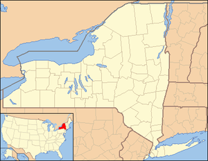 Location of the mouth of the Little Salmon River in New York State | |
The Little Salmon River is a tributary of Lake Ontario located in Oswego County, New York.[3] The river enters Lake Ontario approximately four miles (6.4 km) southwest from the mouth of the Salmon River.
The river was known by the Iroquois as Cas-son-ta-che-go-na, translated as "river of great bark" or "large pieces of bark lying down, ready for building".[5] In addition to its current name, the stream was historically known as Salmon Creek or Little Salmon Creek. The current name was officially adopted by the United States Board on Geographic Names in 1905.[6]
Course
The Little Salmon River drains an approximately 85-square-mile (220 km2) watershed, which is primarily agricultural and residential in nature.[4]
The river rises at the confluence of the North Branch Little Salmon River and South Branch Little Salmon River in the eastern part of the town of Mexico, west of the village of Parish. From there, the river flows northwest through the village of Mexico and the hamlet of Texas before emptying into Lake Ontario at Mexico Point.
Sportfishing
The lower Little Salmon River provides habitat for a variety of resident fish species, including brown bullhead, white suckers, rock bass, largemouth bass, and northern pike. In addition, several lake-dwelling species enter the Little Salmon River during annual spawning runs in the fall, including Chinook salmon, coho salmon, steelhead, and brown trout.[4] In 2015, 3,410 six-inch-long (15 cm) steelhead were stocked in the river by the New York State Department of Environmental Conservation.[7]
The majority of the river is privately owned, and fishing access to the river is limited to Mexico Point State Park and the Mexico Point Boat Launch, both located near the mouth of the Little Salmon River.[8]
See also
References
- ↑ "North Branch Little Salmon River". Geographic Names Information System. United States Geological Survey. Retrieved May 8, 2016.
- ↑ "South Branch Little Salmon River". Geographic Names Information System. United States Geological Survey. Retrieved May 8, 2016.
- 1 2 3 "Little Salmon River". Geographic Names Information System. United States Geological Survey. Retrieved May 8, 2016.
- 1 2 3 "Little Salmon River Coastal Fish and Wildlife Habitat Rating Form" (PDF). New York State Department of State. October 15, 1987. Retrieved May 8, 2016.
- ↑ Beauchamp, William Martin (1907). Aboriginal Place Names of New York (New York State Museum Bulletin, Volume 108). New York State Education Department. pp. 168–169. Retrieved May 8, 2016.
- ↑ "Decision Card: Little Salmon River". United States Board on Geographic Names. April 5, 1905. Retrieved May 8, 2016.
- ↑ "2015 Fish Stocking in Oswego County". NYS Department of Environmental Conservation. Retrieved May 29, 2016.
- ↑ Oswego County Fishing and Hunting (PDF). Oswego County Tourism. p. 22. Retrieved May 8, 2016.