Llansamlet
| Llansamlet | |
 Llansamlet |
|
| Population | 7,041 (2011)[1] |
|---|---|
| OS grid reference | SS696975 |
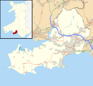
| Principal area | Swansea |
| Ceremonial county | West Glamorgan |
| Country | Wales |
| Sovereign state | United Kingdom |
| Post town | SWANSEA |
| Postcode district | SA7 |
| Dialling code | 01792 |
| Police | South Wales |
| Fire | Mid and West Wales |
| Ambulance | Welsh |
| EU Parliament | Wales |
| UK Parliament | Swansea East |
| Welsh Assembly | Swansea East |
Coordinates: 51°40′N 3°53′W / 51.66°N 03.89°W
Llansamlet is a suburban district of Swansea, Wales, falling into the Llansamlet ward. The area is centered on the A48 road (named Samlet Road and Clase Road in the area) and the M4 motorway.
Similar to many other places in Wales where the name begins with Llan, Llansamlet is named after a saint – Saint Samlet. There is a Saint Samlet's Church in the area on Church Road.
History
Historically, the region was part of the Principality of Deheubarth until the Norman invasions between 1067 and 1101. From 1135 the Normans wrested the region from the Prince of Deheubarth and formed the basis for the Marcher Lordship of Kilvey of comital rank. After the Laws in Wales Act 1535 abolished Marcher lordships, the region was incorporated into the county of Glamorgan. The parish of Llansamlet became part of the borough of Swansea in two boundary changes in 1835 and 1918.[2]
Llansamlet was an important coal mining area from at least the 14th century. Initially coal was mined for export but with the coming of the copper industry in the 18th century much of the output was used for smelting purposes. In 1750 the principal mineral properties were acquired by Chauncy Townsend and they remained in his family until his great-grandson, Charles Henry Smith, relinquished them in 1872. By this time all the best seams had been worked out and output was in decline. Coal-working finally ceased in the first half of the 20th century. Much of the former mining area is now occupied by the Swansea Enterprise Park.
One of the few surviving remains of the coal industry is Scott's Pit, a fine Cornish-style pumping engine house. Its construction can be dated to about 1823/4. John Scott, the owner of the colliery, was a London solicitor who had taken a lease of the property in 1816. Coal started to be produced in 1819 and in the same year a locomotive was supplied by George Stephenson, although it did not prove successful and was soon withdrawn.[3] Scott was unable to operate the pit profitably and pulled out in 1828.[4] The pit then reverted to Charles Henry Smith. It continued in use, sometimes for coal winning, sometimes for pumping, until 1930. It was restored in the 1970s. It is often stated that the pit was sunk in the 1770s by a Captain John Scott, but there is no truth in this: it probably derives from a garbled oral tradition.[5]
Modern Llansamlet
Today the area consists of an urban belt centered on the A48 road and M4 motorway where new housing was built in the early millennium decade. At the west of the area lies the Swansea Enterprise Park and Swansea Vale development area. The north of the area is mainly rural, consisting of farmland.
Transport
Road transport links include the A48 trunk road to the M4 motorway (Junction 44). It has its own railway station to the east, served by the Arriva Trains Wales Swanline service between Cardiff and Swansea.
The railway runs through a cutting, design by Brunel. Owing to the risk of landslip from the earth banks of this cutting, Brunel designed four flying arches to hold the cutting walls apart. For extra stability, these arches were ballasted with high mounds of copper slag.[6]
Notable residents
- Jack Kelsey, Welsh international goalkeeper
- Ruth Madoc, star of the TV show Hi-de-Hi!, grew up here.
- Dai Parker, Wales and British Lion rugby player, brother of Tom Parker, Welsh international rugby union captain
- Lucy Thomas, 19th century businesswoman
References
- ↑ "Community population 2011". Retrieved 13 April 2015.
- ↑ "Borough/County Borough/City of Swansea records". West Glamorgan Archive Service.
- ↑ Reynolds, Paul (2003). Lewis, M.J.T., ed. "George Stephenson's 1819 Llansamlet locomotive". Early Railways 2: papers from the Second International Early Railways Conference. London: Newcomen Society: 165–76.
- ↑ "Early References to Coal Mining History". Retrieved 15 December 2014.
- ↑ Reynolds, Paul (February 1999). "Scott's Pit: new evidence from the north of England". Bulletin of the South West Wales Industrial Archaeology Society. 74: 11–19.
- ↑ Jones, Stephen K. (2006). Brunel in South Wales. II: Communications and Coal. Tempus. pp. 140–142. ISBN 0-7524-3918-9.