Llogara Pass
| Llogara Pass | |
|---|---|
|
Llogara pass through | |
| Elevation | 1,043 m (3,422 ft) |
| Traversed by | road |
| Location | Albania |
| Range | Ceraunian Mountains |
| Coordinates | 40°11′49″N 19°35′51″E / 40.19694°N 19.59750°ECoordinates: 40°11′49″N 19°35′51″E / 40.19694°N 19.59750°E |
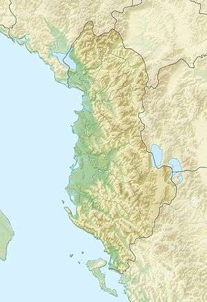
 Llogara Pass Location of Llogara Pass | |
Llogara Pass (Albanian: Qafa e Llogarasë, Greek: Στενό Λογαρά) is a high mountain pass on the Ceraunian Mountains connecting the Dukat Valley in the north with the coastal region of Himara on the southern side. Orikum is the nearest city on the northern side of the pass and Dhërmi, in Himara municipality, is the closest one in the south.
History
In November 1912, during the Himara revolt a Greek unit was positioned on the Llogara in order to defend the region of Himara from Ottoman-Albanian attacks from the direction of Vlorë.[1]
See also
- Albanian riviera
- List of highest paved roads in Europe
- List of mountain passes
- Llogara National Park
References
- ↑ ...], Hellenic Army General Staff, Army History Directorate. [Ed. committee: Dimitrios Gedeon (1998). A concise history of the Balkan Wars, 1912-1913 (1.udg. ed.). Athens: Hellenic Army General Staff. ISBN 9607897072. Retrieved 6 September 2016.
...a strength of about 100 men, to the mountain pass of Logara, to the northwest of Cheimarra. Their mission was to secure the city against any enemy threat from the direction of Aulon (Valona)
External links
This article is issued from Wikipedia - version of the 9/7/2016. The text is available under the Creative Commons Attribution/Share Alike but additional terms may apply for the media files.
