Lobuche
This article is about the mountain in Khumbu, Nepal. For the nearby village, see Lobuche, Nepal. For the 7,367m Himalayan outlier peak in Tibet, see Labuche Kang.
| Lobuche East | |
|---|---|
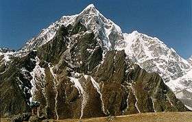 Lobuche East as viewed from Lobuche Alps | |
| Highest point | |
| Elevation | 6,119 m (20,075 ft) (Lobuche East)[1] |
| Prominence | 275 metres (902 ft) |
| Coordinates | 27°57′34.2″N 86°47′23.8″E / 27.959500°N 86.789944°ECoordinates: 27°57′34.2″N 86°47′23.8″E / 27.959500°N 86.789944°E |
| Geography | |
 Lobuche East Location in Nepal | |
| Location | Khumbu, Nepal |
| Parent range | Himalayas |
| Climbing | |
| First ascent | April 25, 1984 |
| Easiest route | Scramble/Rock/Snow Climb |
Lobuche (also spelt Lobuje) is a Nepalese mountain which lies close to the Khumbu Glacier and the settlement of Lobuche. There are two main peaks, Lobuche Far East and Lobuche East (often mistaken for Lobuche West which is a separate mountain further west). At 6,145 metres (20,161 ft), Lobuche East is 26 metres (85 ft) higher. Between the two peaks is a long deeply notched ridge.[2][1]
The first recorded ascent of Lobuche East was made by Laurence Nielson and Sherpa Ang Gyalzen on April 25, 1984.[1]
From Gokyo Ri
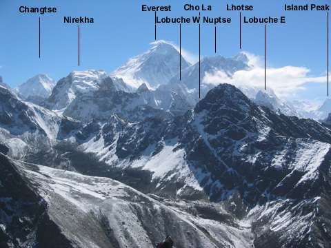
Annotated image of Everest and surroundings as seen from Gokyo Ri.
References
This article is issued from Wikipedia - version of the 10/22/2016. The text is available under the Creative Commons Attribution/Share Alike but additional terms may apply for the media files.