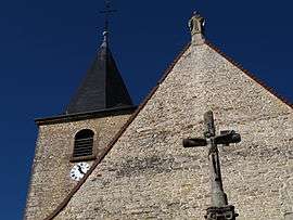
Longwy-sur-le-Doubs
| Longwy-sur-le-Doubs | ||
|---|---|---|
 | ||
| ||
 Longwy-sur-le-Doubs | ||
|
Location within Bourgogne-Franche-Comté region  Longwy-sur-le-Doubs | ||
| Coordinates: 46°57′32″N 5°22′24″E / 46.9589°N 5.3733°ECoordinates: 46°57′32″N 5°22′24″E / 46.9589°N 5.3733°E | ||
| Country | France | |
| Region | Bourgogne-Franche-Comté | |
| Department | Jura | |
| Arrondissement | Dole | |
| Canton | Chemin | |
| Government | ||
| • Mayor (2014–2020) | Pierre Thiébaut | |
| Area1 | 16.46 km2 (6.36 sq mi) | |
| Population (2012)2 | 525 | |
| • Density | 32/km2 (83/sq mi) | |
| Time zone | CET (UTC+1) | |
| • Summer (DST) | CEST (UTC+2) | |
| INSEE/Postal code | 39299 / 39120 | |
| Elevation | 182–189 m (597–620 ft) | |
|
1 French Land Register data, which excludes lakes, ponds, glaciers > 1 km² (0.386 sq mi or 247 acres) and river estuaries. 2 Population without double counting: residents of multiple communes (e.g., students and military personnel) only counted once. | ||

Longwy-sur-le-Doubs is a commune in the Jura department in Franche-Comté in eastern France.
Population
| Historical population | ||
|---|---|---|
| Year | Pop. | ±% |
| 1793 | 530 | — |
| 1806 | 612 | +15.5% |
| 1821 | 588 | −3.9% |
| 1831 | 912 | +55.1% |
| 1841 | 952 | +4.4% |
| 1851 | 974 | +2.3% |
| 1861 | 875 | −10.2% |
| 1872 | 830 | −5.1% |
| 1881 | 800 | −3.6% |
| 1891 | 741 | −7.4% |
| 1901 | 711 | −4.0% |
| 1911 | 745 | +4.8% |
| 1921 | 626 | −16.0% |
| 1931 | 593 | −5.3% |
| 1946 | 540 | −8.9% |
| 1954 | 513 | −5.0% |
| 1962 | 527 | +2.7% |
| 1968 | 525 | −0.4% |
| 1975 | 491 | −6.5% |
| 1982 | 490 | −0.2% |
| 1990 | 498 | +1.6% |
| 1999 | 496 | −0.4% |
| 2006 | 551 | +11.1% |
| 2012 | 525 | −4.7% |
See also
References
| Wikimedia Commons has media related to Longwy-sur-le-Doubs. |
This article is issued from Wikipedia - version of the 10/12/2015. The text is available under the Creative Commons Attribution/Share Alike but additional terms may apply for the media files.